
Most People Don’t Know Theirs
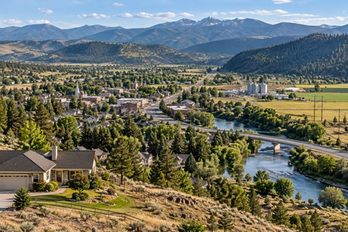
Before you buy another piece of preparedness gear, take a good look at where you live. Not just your house, but the water around you, the roads leading in and out, the farms and food production nearby, the number of people depending on the same stores and fuel stations, the electrical system, the terrain, the natural hazards and the people who make up your community. These things are easy to overlook because most of them work quietly in the background of everyday life.
Now imagine some of the systems you normally depend on stop working. The electricity is out, water service becomes unreliable, stores aren’t being restocked normally, fuel becomes difficult to find and cellular service is intermittent. Maybe a major road is closed as well. In that situation, would where you live make those problems easier to handle, or would your location start making everything harder?
Preparedness tends to focus on things we can buy. Food, water filters, generators, radios, medical supplies and bug-out bags all matter, but those supplies exist inside something much larger: your location. Long before an emergency happens, where you live has already given you certain advantages and weaknesses. It influences your water options, local food production, evacuation routes, natural hazards, infrastructure dependencies and the people and skills available around you.
That doesn’t mean your address determines whether you survive. No simple number could tell you that. Your skills, preparations, community, circumstances and the emergency itself all matter. But your location does have something we could loosely call a survival score, or perhaps more accurately, an Area Resilience Score. The number itself isn’t really the important part. What matters is what you discover while figuring it out.
You are not trying to predict whether your address will survive a disaster. You are trying to discover what your address will require from you when normal systems stop doing the work for you.
Start at Home and Work Outward
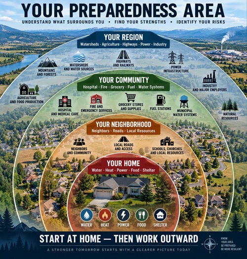
Put your home in the center of a map and start there. Your property is the first layer of your preparedness environment because it contains your shelter, stored supplies, water system, heating, backup power, garden space and immediate resources. Move outward and you reach your neighborhood, where roads, neighbors, buildings and nearby resources become part of the picture. Move farther out and you reach the larger community, where grocery stores, pharmacies, hospitals, fire departments, fuel stations, water systems and emergency services become important.
Continue outward and you begin seeing the larger systems that support the community. These can include watersheds, agricultural land, highways, railways, electrical infrastructure, forests, industries and transportation networks. The useful part of this exercise isn’t simply locating these things. It is understanding how they connect and what depends upon what.
You may have a month’s worth of food but discover that your private well stops working when electricity disappears. Your town may have several grocery stores, but nearly everything inside them may arrive over one highway. A hospital might only be twenty minutes away, but the most practical route to it could cross a bridge vulnerable to flooding. These are the kinds of relationships you want to find because preparedness isn’t only about knowing what resources exist. It is also about understanding the dependencies behind them.
Water: Find Out Where Your Next Water Comes From
Water is a good place to begin because it shows how easy it is to confuse the existence of a resource with actual access to that resource. Start by finding out where your household water really comes from. If you use municipal water, determine whether the original source is groundwater, a lake, reservoir or river. You don’t need to become an expert on the water utility, but you should understand enough to know whether treatment facilities, pumps and electricity are required to move that water from its source to your faucet.
If you have a private well, don’t automatically assume that means you have independent water. A productive well on your property can be an excellent preparedness resource, but find out what happens during a power outage. If an electric pump is the only way to retrieve the water and you have no practical backup for that pump, electricity is still part of your water supply.
Next, look for potential alternative sources such as creeks, lakes, rivers or springs. Finding water does not mean it is automatically safe to drink. Surface water can contain microorganisms, agricultural runoff, chemicals and other contaminants, so appropriate treatment remains necessary. What you are trying to establish at this stage is whether an alternative actually exists and whether you could realistically use it.
A creek a mile from your house might look like a great backup source on a map, but think about what retrieving that water would actually involve. A U.S. gallon of water weighs about 8.3 pounds, so fifteen gallons weighs roughly 125 pounds before you add the containers. If that creek is downhill, across rough ground or difficult to reach in winter, the words “we have a creek nearby” suddenly mean something very different.
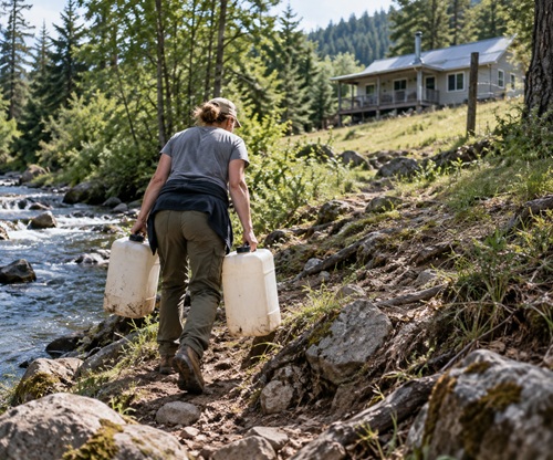
A useful backup source has to be more than a blue line on a map. You need to be able to reach it, collect the water, transport enough home, treat it appropriately and repeat the process if necessary. Stored water remains extremely important because it buys time, but knowing where your next water comes from after your stored supply begins running low gives you another layer of resilience.
Food: Look Behind the Grocery Store
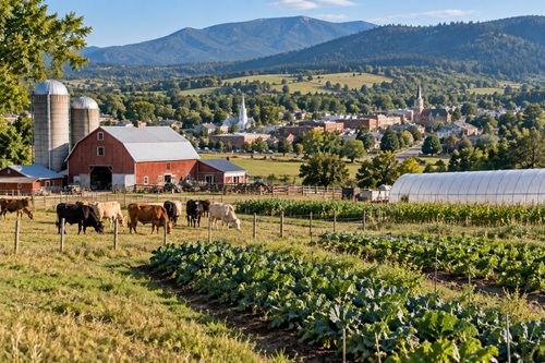
The modern grocery store makes food supply chains almost invisible. Food appears on the shelves, and when it disappears another truck normally arrives. To understand the food resilience of your location, look behind the grocery store and find out what your region actually produces.
Study the land surrounding your community. Look for farms, ranches, orchards, grain operations, greenhouses, farmers markets and food processors. Learn what grows in your climate and how long the growing season lasts. Some areas have the soil, water and climate to support significant agriculture, while other communities depend heavily on food transported from somewhere else.
Nearby farmland shouldn’t be treated as though it automatically becomes your food supply during an emergency. Modern agriculture has dependencies of its own, including fuel, machinery, electricity, transportation, labour and other inputs. What local agriculture does tell you is whether your region possesses the physical capacity, equipment and human knowledge to produce food.
Bring the same question back to your household. Consider whether you could grow at least some food, whether you understand your soil and growing season, whether you know how to preserve seasonal food and whether you know any local producers. Buying locally now can teach you far more about your regional food system than waiting for an emergency to discover who produces what.
Two households could each have six months of stored food and still have very different long-term food resilience. One might be surrounded by productive farmland, water and experienced growers while the other lives in an area where almost everything people eat arrives by truck. The cans on their shelves may look exactly the same, but their locations don’t.
Population: People Create Demand, but They Also Create Capability
Population is often oversimplified in preparedness discussions. More people can mean greater demand for food, fuel, water, medical care and emergency services, especially when supplies are disrupted. At the same time, people bring skills, equipment, knowledge and labour. A rural area with very few residents may have little competition for resources, but the nearest hospital could be hours away and there may be fewer mechanics, medical professionals, tradespeople and emergency services available.
Instead of simply asking whether there are too many people around you, consider how many people depend upon the same systems you do. Look at the grocery stores, fuel stations, pharmacies, hospitals and water systems in your area and think about how many people those facilities normally support. Then consider what happens if supply falls while demand suddenly increases.
The other half of the picture is community capability. A small town containing farmers, tradespeople, medical workers, volunteer firefighters, mechanics and people accustomed to solving practical problems may possess forms of resilience that aren’t visible in a population-density number. An extremely isolated household may face less competition for supplies while having very little help when a problem exceeds what one family can handle. Understanding your area therefore means looking at resource pressure and human capability together.
Natural Hazards: Don’t Study Them One at a Time
Most people already know the obvious natural hazards associated with where they live. Someone in wildfire country thinks about wildfire, someone near a river thinks about flooding, coastal residents understand severe storms and people living in earthquake country know earthquakes are possible. A better area study goes beyond identifying individual hazards and looks at what happens when they overlap or trigger other failures.
A wildfire can close roads and interrupt electricity. A winter storm can knock out power while blocking transportation and creating a heating problem. Extreme heat becomes considerably more serious when electricity and air conditioning disappear. Drought can reduce available water while simultaneously increasing wildfire danger. In each case, the original event matters, but so do the secondary problems it creates.
The GET READY Wildfire Hazards Map can help you examine wildfire exposure around your property and travel routes. The GET READY Fault Lines Map can help identify seismic considerations, while the GET READY Climate Atlas Map provides another view of environmental and climate conditions that may affect longer-term preparedness.
When using these maps, don’t stop after identifying a hazard. Look at what the hazard intersects. A wildfire area is useful information, but a wildfire area crossing your primary evacuation corridor is much more important. A floodplain deserves additional attention when the bridge carrying your alternate route crosses it. The relationship between the hazard and something you depend upon is often where the real vulnerability appears.
Transportation: Three Roads May Actually Be One
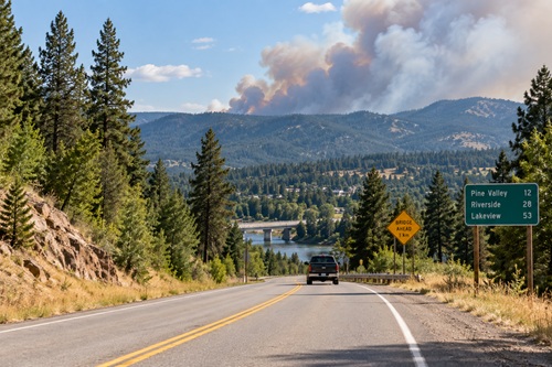
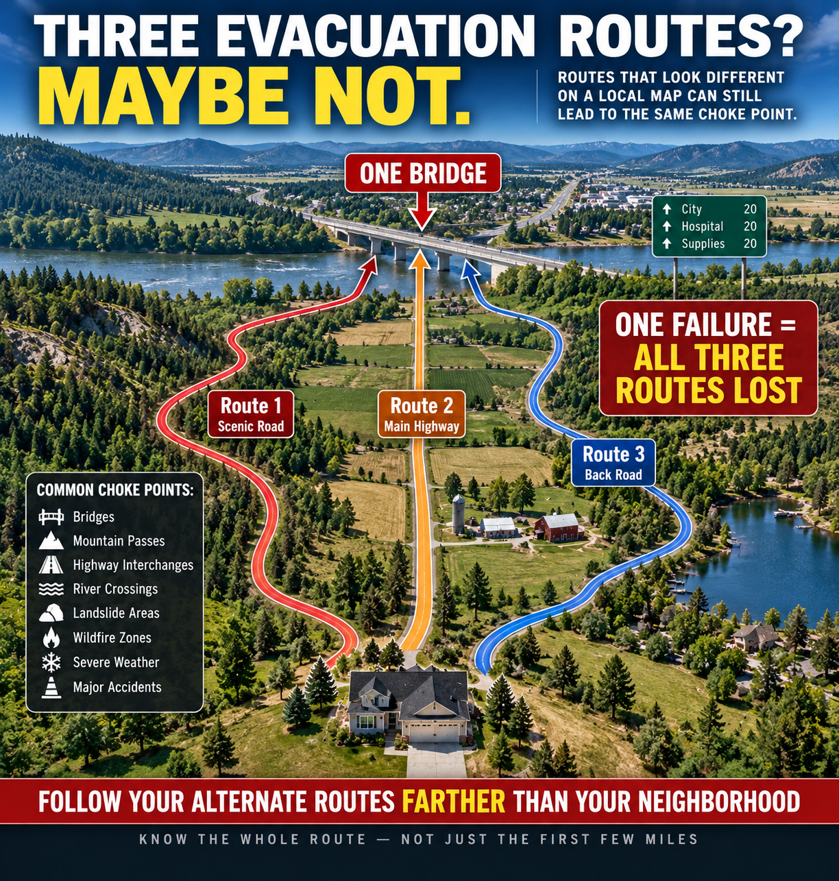
Find your primary route out of your neighborhood and then identify alternatives. Don’t stop when you find two or three different road names. Follow those roads farther and see where they actually go. You may discover that three supposedly different routes eventually cross the same bridge, enter the same highway interchange, pass through the same river valley or climb through the same mountain pass. On a local map you appear to have three routes, while functionally you may have only one.
Think about what could close those routes. Wildfire, flooding, heavy snow, landslides, damaged bridges, accidents or traffic congestion could all turn familiar roads into dead ends. Do the same exercise with important destinations such as hospitals, pharmacies, family members and possible evacuation locations. A good alternate route should actually remove the dependency that makes the primary route vulnerable.
Then remove your vehicle from the exercise and look at your surroundings again. Determine what you could realistically reach on foot. A creek ten minutes away by car becomes a different resource when you have to carry water home. A hospital thirty minutes away may effectively disappear from your available resources if transportation fails. In preparedness, distance sometimes makes more sense when measured in walking time rather than driving time.
Industrial and Environmental Hazards: Find What You Normally Drive Past
Not every local hazard comes from nature. Look at the wider area for industrial facilities, mines, rail corridors, pipelines, refineries, chemical facilities, contaminated sites and other locations where an accident could affect surrounding communities. The GET READY Toxic Hazards Map can help identify potential hazards that deserve further investigation.
Seeing something on a map doesn’t mean it presents an immediate danger. It gives you something specific to understand. Consider whether it is upstream from your community, how terrain might influence an incident, what direction prevailing winds normally move and whether an accident could affect a major road or water source. You might also discover that your normal evacuation route takes you toward a potential hazard rather than away from it.
That is the purpose of the exercise. A vague concern isn’t very useful. Knowing what the concern is, where it is and how it might affect something you depend upon gives you something you can actually plan around.
Strategic Considerations: Understand What Is Nearby
Military installations, major ports, transportation hubs and nationally significant infrastructure can affect an area’s risk profile depending upon the type of emergency being considered. The purpose of examining these locations is not to pretend that anyone can predict exactly what would happen during a major conflict. It is simply another part of understanding the environment surrounding your home.
The GET READY Nuclear Fallout Map provides another layer that can be considered when studying this type of risk. Treat the information as a planning aid rather than a prediction. If something in your area deserves attention, use it to think through practical questions such as sheltering capability, communications, supplies, warning systems and the conditions under which evacuation would or would not make sense.
A map becomes useful when it helps replace a vague fear with a specific preparedness question.
Look at Your Property Differently
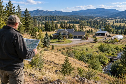
After examining the wider area, bring the investigation back to your own property. Look at elevation, drainage, vegetation, road access and surrounding terrain. Notice where water goes during heavy rain, where snow accumulates, where vegetation is thickest and which directions wildfire could potentially approach from. Look at garden space, possible water-storage locations, alternate access and places where backup energy equipment could be safely operated.
The GET READY Property Scout Map can help when examining your current property or evaluating another location, particularly rural land, homesteads or possible relocation properties.
A cabin beside a river may look ideal until you discover that its only access road crosses a flood-prone bridge. A heavily wooded property may provide privacy and firewood while increasing wildfire concerns. Large acreage may offer plenty of apparent gardening space while having poor soil or unreliable water. A property shouldn’t be judged by how much it looks like a survival retreat. What matters is whether its water, access, terrain, hazards and resources work together in a way you can realistically manage.
Infrastructure Dependency: Find the Dominoes
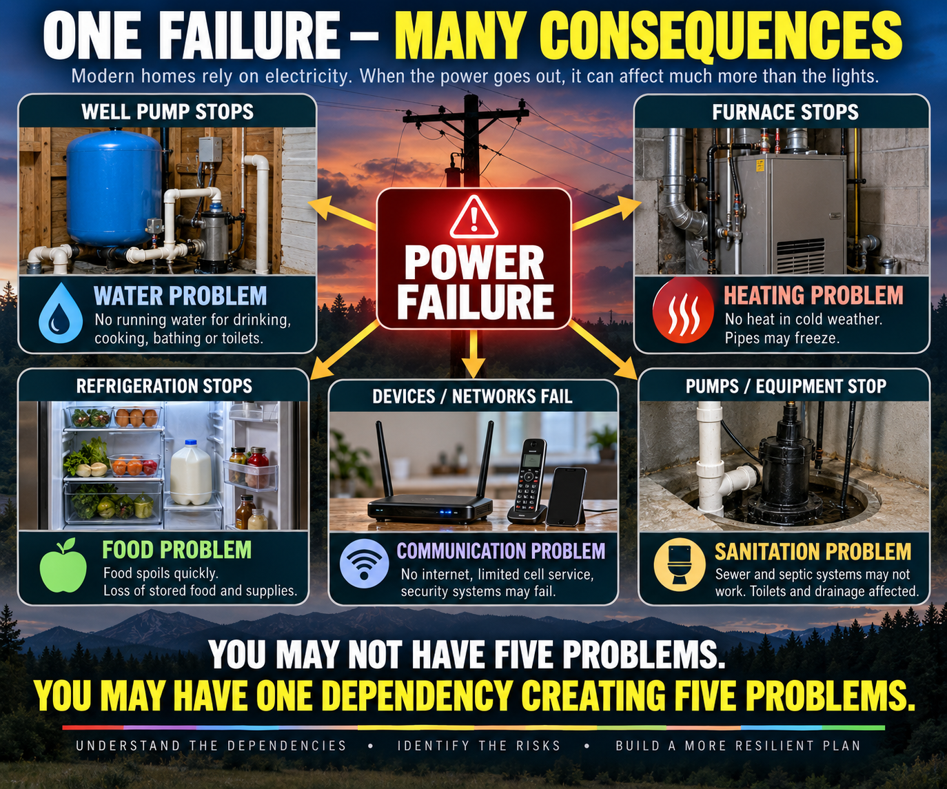
This is where the exercise becomes especially useful. Imagine the electricity goes out tonight and follow the consequences beyond the lights. Does your well stop? Does your furnace stop? Does refrigeration stop? Can you cook? Can you recharge communications equipment? Does any sewage or septic equipment require power? Continue until you have identified everything in the household that quietly assumes electricity will always be available.
Then repeat the exercise with municipal water, heating fuel, cellular service, internet access and vehicle fuel. What you are looking for are dominoes. Your household may appear to have five separate problems – no water, no heat, no refrigeration, limited communications and sanitation trouble – but tracing them backward may reveal that four of those problems have exactly the same cause: electricity.
You don’t actually have five independent problems. You have one dependency creating five consequences. That discovery can completely change where preparedness money and effort should go. Backup electricity might restore the well. An independent heat source could remove heating from the electrical dependency chain. Stored water could temporarily bypass the well altogether. Offline information could keep important knowledge available when internet service disappears.
The objective isn’t to make your household completely independent of modern infrastructure. A more realistic goal is to identify the dependencies that create the most serious consequences and build practical alternatives around those first.
Take Dependency Thinking Outside the House
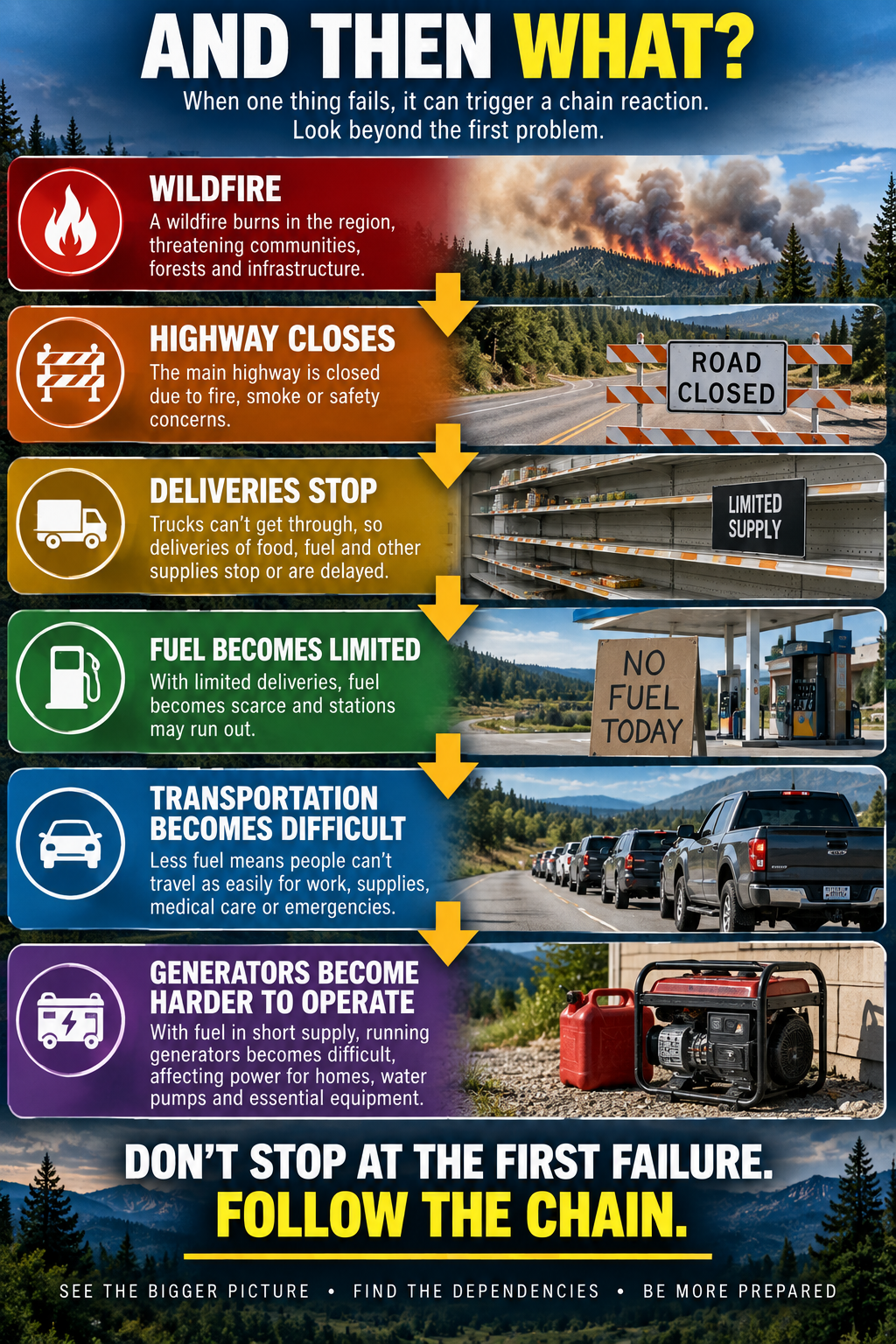
Once you understand dependency chains inside your home, apply the same thinking to your community. Imagine a wildfire closes the main highway. That is already a serious problem, but don’t stop there. If the highway is the main route used by delivery trucks, food and fuel deliveries may be interrupted. If fuel stations aren’t replenished, transportation becomes more difficult and generators become harder to operate. What started as a wildfire problem has now affected transportation, food, fuel and backup power.
The same thinking can be applied to other situations. A flood may close a bridge and separate part of the community from a hospital, pharmacy or emergency services. A prolonged electrical outage could stop water pumps, which creates a water problem, which eventually becomes a sanitation problem. A major communications outage might make it harder for people to receive warnings, contact family members or coordinate assistance. These aren’t necessarily separate emergencies. They can be different stages of the same failure.
A simple way to uncover these chains is to keep asking “And then what?” If the electricity fails, then what happens next? If the well stops, what happens after the stored water is used? If the highway closes, what happens to deliveries? If fuel deliveries stop, what else becomes difficult?
Keep following the chain until you reach a point where your current preparations no longer provide a good answer. That point deserves attention because you have probably uncovered a real preparedness gap.
Community Capability: Know Who Is Around You
Maps can show roads, terrain and hazards, but they cannot completely show what the people around you know. Your community may contain farmers, nurses, doctors, mechanics, electricians, gardeners, carpenters, equipment operators, volunteer firefighters, radio operators, livestock owners and people experienced in food preservation. Those capabilities matter during prolonged disruption.
A generator is useful, but a generator combined with someone who knows how to diagnose and repair it is more useful. A garden provides food, but a community containing experienced growers and people who know how to preserve a harvest possesses another level of capability. Individual preparedness gives households breathing room and reduces pressure on community resources, while community capability extends what becomes possible when individual resources eventually reach their limits.
This doesn’t require knowing everybody in town or forming a formal survival group. Knowing your neighbors, understanding local organizations and paying attention to the skills that exist around you can tell you a great deal about the resilience of the place where you live. A location shouldn’t be evaluated only by its physical resources. Human knowledge and practical capability belong in the assessment too.
Build Your Area Study With GET READY Maps
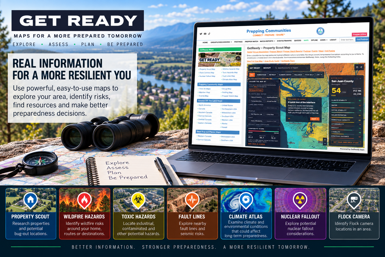
Now bring the different pieces together. GetReady.Team – Get Your Own Area Study Map provides a useful starting point for treating your location as an area to investigate rather than simply an address.
Use the Property Scout Map to examine the property and surrounding area, then compare the same location using the Wildfire Hazards Map, Toxic Hazards Map, Fault Lines Map, Climate Atlas Map and Nuclear Fallout Map. The Flock Camera Map is also available for people interested in understanding where Flock camera infrastructure is present.
The real value comes from comparing the maps instead of looking at each one independently. Look for wildfire exposure along evacuation routes, industrial hazards near waterways, terrain that restricts travel and roads that eventually converge on the same choke point. Pay attention to where important resources are concentrated and whether several things you depend upon are vulnerable to the same event.
A hazard by itself is useful information, but what really matters is whether that hazard intersects something you depend upon. A wildfire zone crossing your evacuation route, an industrial hazard near a water source or a floodplain surrounding the bridge you need to reach town changes the situation. Those connections are what you’re trying to uncover during an Area Study.
When several different maps or observations point toward the same weakness, pay attention. You may have found one of the critical dependencies in your area. The maps should therefore be treated as a starting point rather than the final answer. They help identify things worth investigating, but eventually you should compare what they show with local emergency information and what you can actually see on the ground.
Calculate Your Area Resilience Score
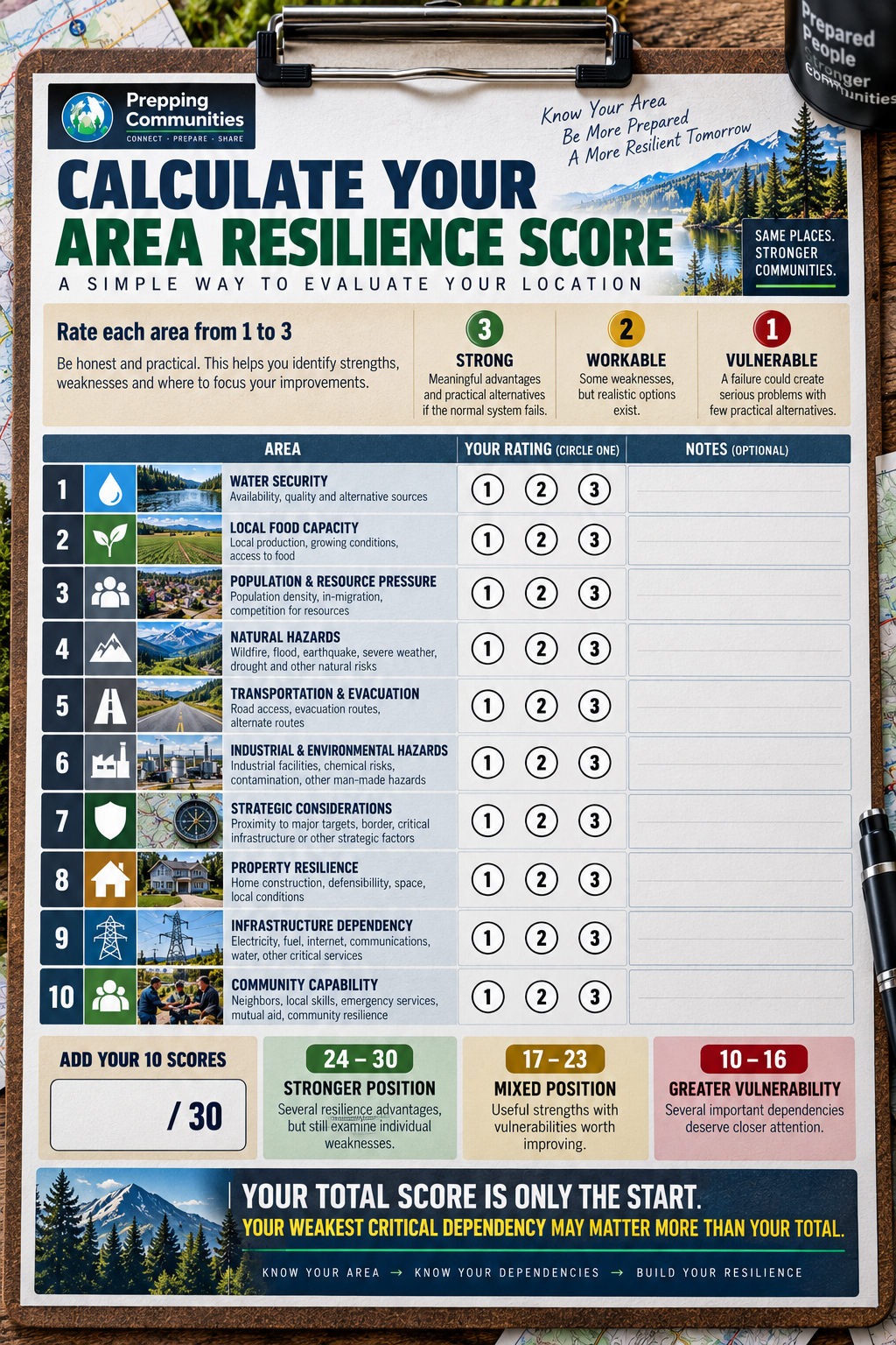
Once you have worked through your area, give the location a simple score. This isn’t meant to be scientific, and it certainly isn’t predicting whether you will survive an emergency. The score is simply a way to make yourself examine important parts of your location instead of assuming they are fine because they work today.
Evaluate ten areas: water security, local food capacity, population and resource pressure, natural hazards, transportation and evacuation, industrial and environmental hazards, strategic considerations, property resilience, infrastructure dependency and community capability. Give each area 3 points if it is Strong, 2 points if it is Workable and 1 point if it is Vulnerable.
A Strong rating means your location has meaningful advantages in that area and you have practical alternatives if the normal system fails. Workable means there are weaknesses or dependencies, but you have realistic ways of dealing with them. Vulnerable means a failure in that area could quickly create a serious household problem and you currently have few practical alternatives.
With ten categories, the maximum score is 30. A score from 24 to 30 suggests that your location has several useful resilience advantages, although individual weaknesses still matter. A score from 17 to 23 suggests a mixture of strengths and vulnerabilities where targeted improvements could make a meaningful difference. A score from 10 to 16 suggests that several important location or infrastructure dependencies deserve closer attention.
Write down the number, but don’t become too attached to it. The score helps organize the exercise. What you discovered while calculating it is far more important.
Your Weakest Link May Matter More Than Your Score
Imagine your location scores 27 out of 30. That sounds excellent, but suppose the one category you rated Vulnerable is water. Municipal water is your only source, you have limited stored water and there is no practical alternative nearby. Your high overall score hasn’t made that water problem disappear.
This is why averages can hide important preparedness weaknesses. Preparedness can fail at the weakest critical dependency, not at the average of all your strengths. A household can be strong in nine different areas and still have one weakness capable of forcing people to leave.
Go back through your assessment and pay particular attention to every category you rated Vulnerable. Then trace the consequences. If municipal water stops, you begin using stored water. Once the stored water is depleted, you need another source. If that source requires a vehicle, your water plan now depends upon transportation. If fuel becomes unavailable, the transportation solution may disappear as well.
A problem that initially looked like a water problem has become a water, transportation and fuel problem. This is where “And then what?” becomes more useful than the numerical score. Keep following the chain until you reach something your current preparedness cannot solve. That point is usually where your next preparedness improvement belongs.
Ground Truth What You Found
Don’t finish your Area Study sitting behind a computer. Maps can show an enormous amount of useful information, but eventually you need to see whether what looks good on a screen actually works on the ground.
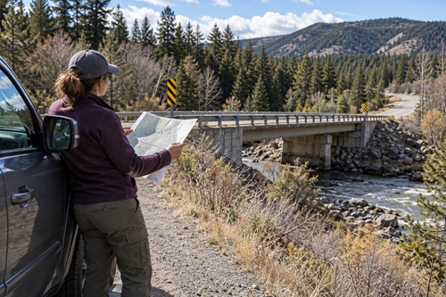
Drive your primary evacuation route and then drive the alternative. Find the bridge you identified. Look at the creek you considered an emergency water source. Visit the farmers market. Look at nearby agricultural areas. Pay attention to steep terrain, drainage, vegetation and road conditions. If practical and safe, walk some of the distances you assumed you could cover without a vehicle.
You may discover that a creek that looked close on a map sits at the bottom of a steep embankment. An alternate road may be poorly maintained or unusable during part of the year. A bridge may be a much more obvious choke point when you actually see it. A road that appears to provide an alternate evacuation route may simply reconnect with the same highway a few miles later.
You may also discover useful resources you never noticed on a map. There could be another road, a community water source, agricultural land, a useful trail, a community building or another local resource you have driven past hundreds of times without considering its preparedness value.
This process is often called ground truthing. The map tells you what appears to be there. Ground truth tells you whether it actually works for you. Both are useful, but neither should completely replace the other.
Build Your Area Resilience Profile
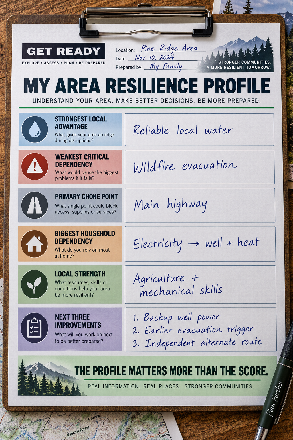
Once you have completed the research and looked at the area yourself, stop worrying about the numerical score for a moment. The real result of this exercise should be an Area Resilience Profile describing what you now understand about where you live.
You should be able to identify your strongest local advantage and your weakest critical dependency. You should know where your normal water originates and where alternative water might come from. You should have a better understanding of local food production and how dependent your community is on outside supplies. You should know your primary evacuation route, your best alternative and whether those routes share a common choke point.
Your profile should also identify which natural hazards matter most where you live and whether those hazards could interfere with water, transportation, electricity or other important systems. You should know which outside system your household depends upon most heavily. For many households that may be electricity. For others it could be municipal water, transportation or heating fuel. Finally, you should have a better idea of the skills and capabilities that exist in your community.
A completed profile might read something like this: Our strongest advantage is reliable local water. Our biggest weakness is wildfire evacuation. Two of our three practical evacuation routes eventually depend on the same highway. Our house is highly dependent on electricity because losing power also affects the well pump and primary heat. Local food production is reasonably good, and the community has strong agricultural and mechanical skills. Our next priorities are backup power for the well, an earlier wildfire evacuation trigger and finding another route that doesn’t depend on the main highway.
That tells you considerably more than simply saying your survival score is 25. It tells you what is strong, what is weak and what you should probably work on next.
Turn Weaknesses Into Preparedness Projects
Finding weaknesses in your location does not automatically mean you should move. Many vulnerabilities can be reduced, and identifying them before an emergency gives you time to do something about them.
If water is your weakness, the next project might involve increasing stored water, improving your treatment capability, researching rainwater collection where appropriate, developing backup power for a well or identifying a realistic alternative source. If electricity creates several dependency chains, determine which electrical loads are genuinely important and develop backup power around those rather than assuming you need enough generation to operate your entire house normally.
If evacuation is weak, drive the alternative routes and establish destinations in more than one direction. Think about the conditions that would cause you to leave early rather than waiting until everyone else is trying to leave. If local food availability is poor, stored food may deserve greater emphasis, while gardening and preservation skills may become more valuable. If community capability is the weakness, one of the most useful preparedness projects might simply be getting to know more of your neighbors.
The goal isn’t to eliminate every vulnerability. That probably isn’t possible. The goal is to prevent a weakness you could have discovered today from becoming a surprise during an emergency.
Test Your Location Against Different Situations
Your Area Resilience Score isn’t permanent because the strengths and weaknesses of a location change with the situation. A house can perform very well during one emergency and poorly during another.
Take your completed Area Resilience Profile and imagine a seven-day power outage. Which weaknesses become important first? Now imagine a wildfire threatening the area during late summer and look at the same profile again. Try a severe winter storm, a transportation disruption or a prolonged water outage. Each scenario will place pressure on different parts of the system.
A route that works perfectly during a power outage might be unusable during wildfire. A creek that provides excellent backup water during spring runoff might be much less reliable late in the summer. A home that handles summer power outages easily could have a serious heating dependency during winter.
This is why there really isn’t one permanent survival score for an address. Resilience changes with the emergency, the season and the conditions. The score gives you a starting point, while running different scenarios teaches you how your location actually behaves.
Don’t Search for the Perfect Location
Once people begin studying locations this way, there can be a temptation to search for somewhere that scores perfectly in every category. That place probably doesn’t exist.
Mountain communities may have abundant water, lower population density and strong local skills while dealing with wildfire, winter access and limited medical care. Agricultural regions may have tremendous food-producing capacity while facing drought, flooding or severe weather. Cities can be highly dependent upon infrastructure while also providing excellent medical care, specialized skills and emergency services.
Every location involves tradeoffs. The better question isn’t whether a location has weaknesses. It is whether you understand those weaknesses and whether they can realistically be prepared around.
A known weakness can become part of your plan. An unknown weakness remains waiting to surprise you.
Preparedness Action Plan
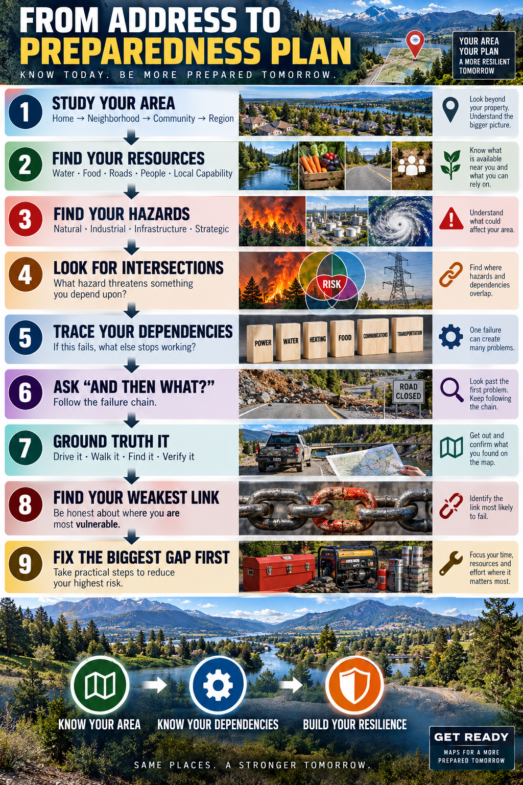
Set aside some time this week and begin your own Area Study. Put your home in the center of the map and work outward through the property, neighborhood, community and surrounding region. Find out where your normal water really comes from and identify at least one possible alternative. Study the food production surrounding your community and determine how dependent the area is on outside supplies.
Look at the natural hazards that realistically affect your area, but don’t stop after identifying them. Look for what those hazards intersect. Pay particular attention to roads, bridges, water sources, electrical infrastructure and other systems you depend upon. Trace your primary evacuation route and at least one alternative all the way out of the area. Make sure two supposedly different routes don’t eventually depend on the same bridge, highway, mountain pass or other choke point.
Use the GET READY maps to examine the same location from several perspectives. Compare what you find rather than treating each map as a separate exercise. Look for places where multiple risks or dependencies overlap, then investigate those areas more closely.
Next, examine the systems inside your home. Start with electricity and follow everything that stops working when power disappears. Repeat the exercise with water, heating fuel, communications and transportation. Keep asking “And then what?” until you find the point where your existing preparations stop providing an answer.
Finally, go outside and verify what you found. Drive the routes, look at the terrain, find the water source, inspect the bridge and learn your area with your own eyes. When you finish, write a short Area Resilience Profile identifying your strongest advantage, weakest critical dependency and the three improvements that would make the greatest difference.
You don’t have to solve everything this weekend. You need to know what deserves your attention next.
Key Takeaways
Your address does not determine whether you survive an emergency, and no numerical score can predict that. Where you live does, however, influence the resources, hazards, dependencies and options available when normal systems are disrupted. Understanding those conditions gives you a much better foundation for deciding where your preparedness time and money should go.
Water nearby is not necessarily usable water. Three roads are not necessarily three independent evacuation routes. A private well is not completely independent if electricity is the only way to retrieve the water. A community with fewer people isn’t automatically more resilient if essential services and useful skills are hours away.
Some of the most important vulnerabilities are not individual hazards at all. They are dependencies connecting several systems together. Electricity may support water, heat, refrigeration and communications. One highway may support food, fuel and medical deliveries. One bridge may determine whether part of a community can reach emergency services.
That is why one of the most useful questions you can learn to ask is “And then what?” The power goes out, so what happens next? The highway closes, so what does that affect? The water stops, so what becomes difficult after the stored supply is gone? Follow the consequences far enough and you eventually find the point where preparation matters.
Your total Area Resilience Score can help organize the exercise, but your weakest critical dependency may tell you much more. The goal isn’t to find a perfect address. The goal is to understand the address you already have well enough that its weaknesses don’t surprise you.
Know your area. Know what it depends upon. Know what happens when those dependencies fail. Then build your preparedness around what you actually discover.
Watch: Your Address Has a Survival Score
For another look at the idea behind this exercise, check out our video Your Address Has a Survival Score (Most People Don’t Know Theirs). The video looks at eight factors that can influence how well a location handles serious disruption, including water access, population, local food production, natural hazards and dependence on critical infrastructure.
Watch Your Address Has a Survival Score (Most People Don’t Know Theirs)
The video introduces the idea of looking at your location differently, while this lesson gives you a way to actually investigate your property, community and surrounding area. Use the two together and, more importantly, take what you learn outside and compare it with the place where you actually live.
The most valuable result isn’t the number you end up with.
It’s what you now know about where you live that you didn’t know before.
© Prepping Communities. This content is for informational purposes only and not professional advice. Use at your own risk.
Terms | Privacy | Guidelines