
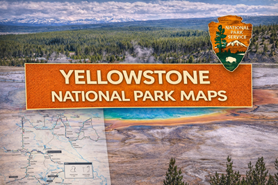
This PDF is a comprehensive road map and visitor guide for Yellowstone National Park, designed primarily for navigation, orientation, and trip planning across one of the largest and most geologically active parks in the United States. It combines a large-scale park map with inset detail maps, route distances, and key points of interest, making it a practical tool for both first-time visitors and experienced travelers.
The main map (page 1) is centered around Yellowstone’s iconic Grand Loop Road system, which forms a figure-eight pattern connecting major destinations such as Old Faithful, Canyon Village, Mammoth Hot Springs, and Yellowstone Lake. The map clearly shows distances (e.g., the full Grand Loop at 142 miles) and highlights major geothermal features like geyser basins, hot springs, and mud pots. Elevations of surrounding peaks and passes are also labeled, reinforcing the park’s mountainous terrain. This layout emphasizes that travel in Yellowstone is largely road-dependent, with key attractions spread far apart and requiring careful route planning.
In addition to navigation, the map highlights hydrothermal and natural features, including well-known sites like Grand Prismatic Spring, Norris Geyser Basin, and the Upper and Lower Falls of the Yellowstone River. Rivers, lakes, and waterfalls are extensively labeled, giving users a strong sense of the park’s water systems. The presence of the caldera boundary (visible on the map) underscores Yellowstone’s identity as a massive volcanic system, which shapes much of the landscape and its geothermal activity.
The reverse side (page 2) expands the scope by including a regional map connecting Yellowstone to Grand Teton National Park and surrounding towns. This provides context for access routes and nearby infrastructure, such as Jackson, Cody, and Bozeman. It also includes practical visitor guidance, such as wildlife safety rules (e.g., maintaining distance from bears and bison), road conditions, and seasonal closures—especially important given that many roads are closed during winter months.
Overall, this PDF serves as a high-level navigation and planning map, rather than a detailed hiking guide. It helps users understand how to move through Yellowstone, where major attractions are located, and how the park connects to the broader region. For preppers or outdoor users, it highlights key realities: long travel distances, reliance on limited road networks, seasonal accessibility, geothermal hazards, and the need to plan routes, fuel, and time carefully in a vast and dynamic environment.
© Prepping Communities. This content is for informational purposes only and not professional advice. Use at your own risk.
Terms | Privacy | Guidelines