
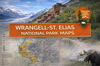
These PDFs focus on Wrangell–St. Elias National Park and Preserve in Alaska, combining a detailed historical guide of the Kennecott mining district with a broader land ownership and access map. Together, they provide both a human history perspective and a modern navigation and land-use understanding of one of the largest and most remote national parks in the United States.
The Kennecott Mines guide (file0) tells the story of a massive copper mining operation deep in the Alaskan wilderness. As described on page 1, the discovery of extremely high-grade copper ore in the early 1900s led to the rapid development of an industrial mining complex in an otherwise isolated mountain region. The construction of the Copper River and Northwestern Railway—highlighted in the text—was a critical achievement that allowed ore to be transported to market. The document outlines how the operation grew into a highly profitable enterprise, producing millions of tons of ore before eventually declining and closing in 1938. The images and layout on page 1 visually reinforce this story, showing historic photos of miners, equipment, and the mill complex.
The guide also provides insight into daily life and working conditions in such a remote environment. As noted in the “Mill Camp vs. Mine Camp” section, workers experienced vastly different living conditions depending on their role, with some enjoying relatively comfortable facilities while others endured harsh, high-altitude conditions. Page 2 shifts to present-day use, describing Kennecott as a preserved historic landmark and gateway to wilderness exploration, while also emphasizing serious safety considerations—including unstable structures, wildlife (bears and moose), and the challenges of backcountry travel where rescue is limited and self-reliance is essential.
The land status map (file1) provides a completely different but equally important perspective. It shows the complex mix of federal, state, Native corporation, and private lands within the park boundaries. As illustrated on the map, large portions of the park are interspersed with non-federal lands, especially around areas like McCarthy and along road corridors. The document stresses the importance of understanding land ownership and respecting access rights, noting that there are approximately 750,000 acres of non-federal land within the park. This makes navigation and planning more complex than in most national parks.
Overall, these PDFs present Wrangell–St. Elias as a vast, rugged, and layered environment, where industrial history, wilderness, and modern land management intersect. They highlight not only the scale and isolation of the park but also the need for careful planning—whether navigating historic sites, traveling in remote backcountry, or simply understanding where you are allowed to go. For preppers or outdoor users, the key takeaways are clear: extreme remoteness, limited infrastructure, complex land access, and the necessity of self-sufficiency in one of North America’s most unforgiving landscapes.
© Prepping Communities. This content is for informational purposes only and not professional advice. Use at your own risk.
Terms | Privacy | Guidelines