
These PDFs are a set of campground maps for Sequoia & Kings Canyon National Parks, each representing a different campground and offering a practical, site-level view of camping infrastructure in a mountainous forest environment. Together, they provide a consistent look at how campgrounds are organized, managed, and adapted to varying terrain conditions across the park system.
The Buckeye Campground map (file0) is one of the simpler layouts, paired with rules and operational notes such as quiet hours, generator use, and occupancy limits. It emphasizes basic campground structure and expectations, including limited vehicle access and reliance on nearby facilities like Hospital Rock for additional services. This reflects a smaller, more basic campground setup where users need to be aware of limited on-site amenities.
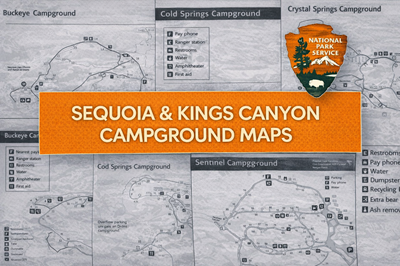
The Cold Springs and Crystal Springs campground maps (files1 and 2) provide more detailed layouts. As seen on the Cold Springs map, icons identify key features such as restrooms, water sources, ranger stations, and amphitheaters, while the Crystal Springs map adds more logistical detail, including overflow parking at another campground and clearly marked service features like dumpsters, recycling, and bear boxes. These maps show how even mid-sized campgrounds are carefully organized with essential services distributed across loops or clusters of sites.
The Sentinel Campground map (file3) presents a larger, more developed campground layout, with multiple loops and a dense concentration of campsites. As visible on the map, infrastructure such as pay phones, water points, and visitor services are centrally located, allowing for easier access. The layout highlights how campground design scales up in more popular areas, with more complex internal road systems and higher site density.
The Dorst Creek Campground map (file4) is the most complex and extensive of the set. As shown on the map, it includes hundreds of sites divided into different camping styles—RV, tent, walk-in, and group sites (A–E). It also features a wide range of infrastructure including a registration booth, dump station, shuttle stops, amphitheater, and trailhead access. The campground is segmented into multiple zones, reflecting both its size and its role as a major camping hub within the park.
Overall, these PDFs collectively illustrate how Sequoia & Kings Canyon manage a range of campground types—from small and simple to large and highly structured. They serve as detailed navigation and planning tools, helping users understand campsite layouts, facility locations, and access points. For outdoor users or preppers, they highlight important considerations such as planning for limited services, understanding campground density, and recognizing how terrain and popularity influence campground design and logistics.
© Prepping Communities. This content is for informational purposes only and not professional advice. Use at your own risk.
Terms | Privacy | Guidelines