
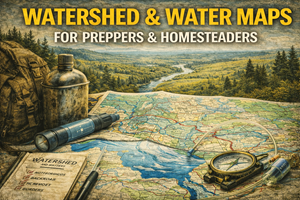
Understanding where water comes from, where it goes, and why guessing gets people sick or stranded
If there is one map type that separates theoretical preparedness from real-world survival, it’s water and watershed maps.
Most people think about water in very simple terms: Is there a creek nearby? Is there a lake?
Preppers and homesteaders need to think several layers deeper:
- Where does that water originate?
- What flows into it upstream?
- How does it behave seasonally?
- Where does contamination travel?
- Where will water appear — or disappear — during stress events?
Watershed maps answer these questions. They don’t just show water — they show water logic. And when infrastructure fails, water logic matters more than almost anything else.
What watershed & water maps actually show
Water and watershed maps typically display:
- rivers, streams, and tributaries
- drainage basins and sub-basins
- watershed boundaries
- direction of flow
- lakes, reservoirs, wetlands, and springs
- sometimes aquifers and recharge zones
A watershed is the area of land where all water drains to a common outlet. Every drop of rain that falls inside that boundary eventually flows to the same river, lake, or coastal point.
In practical terms, watershed maps tell you:
- what influences your water source
- what affects areas downstream from you
- where pollution will travel
- where water will concentrate during storms
This is not academic information. It’s everyday reality once systems strain.
Why watershed maps matter for preparedness
1) Water is not isolated — it’s connected
People often assume a water source is “clean” because it looks remote or natural. Watershed maps remind us that water is a collector. Everything upstream matters:
- farms
- towns
- industrial sites
- roads
- mining areas
- wildfire burn zones
Contamination doesn’t respect distance. It follows gravity.
Watershed awareness helps you judge relative risk, not just proximity.
2) Surface water behaves very differently by season
A stream that looks reliable in spring may disappear in late summer. A dry wash can become a violent channel after heavy rain.
Watershed maps help you understand:
- which streams are fed by snowpack vs rainfall
- which basins drain quickly
- which areas collect runoff
- where flash flooding is likely
Preparedness planning that ignores seasonality is incomplete.
3) Flooding and scarcity often come from the same systems
Ironically, the same watershed that causes flooding during storms can be completely dry months later. Watershed maps reveal:
- narrow basins that flood aggressively
- wide basins that drain slowly
- low points where water accumulates
- areas that dry out first during drought
This dual nature is critical for route planning, shelter siting, and long-term homesteading.
Why water maps matter even more for homesteaders
For homesteaders, water is not just survival — it’s production.
Watershed and hydro maps inform:
- well placement and recharge expectations
- surface water capture opportunities
- pond and swale placement
- erosion control
- livestock watering strategy
- garden irrigation planning
Homesteaders who fight water patterns spend years fixing problems that maps could have predicted in an afternoon.
Understanding how water moves across and through your land allows you to work with it instead of constantly repairing damage.
Surface water vs groundwater (and why maps matter)
Surface water
Includes rivers, streams, lakes, ponds, and seasonal channels. It’s:
- visible
- often easier to access
- more vulnerable to contamination
- highly seasonal
Watershed maps help you judge reliability, not just presence.
Groundwater
Includes aquifers and underground flow systems. It’s:
- less visible
- slower to change
- harder to contaminate quickly
- dependent on recharge areas
Some water maps include aquifer boundaries or recharge zones. These are invaluable for long-term planning.
A well without watershed context is a gamble.
Contamination logic: the part people get wrong
During disruptions, people often rush toward water without thinking about:
- upstream activity
- runoff from roads and towns
- sewage overflow during power loss
- wildfire ash and debris
- agricultural chemicals
Watershed maps help you ask better questions:
- What lies upstream of this point?
- How far does that activity extend?
- How fast does water move through this basin?
- Where does debris concentrate?
Preparedness is not just about finding water — it’s about choosing the least-bad option under imperfect conditions.
Real-world prepper use cases for watershed maps
Choosing safer water collection points
Watershed maps help identify:
- upstream headwaters vs downstream collection points
- tributaries with less upstream exposure
- natural filtration zones like wetlands
Planning movement during storms
Knowing drainage patterns helps you:
- avoid flash-flood channels
- choose higher ground routes
- avoid roads that follow narrow basins
Evaluating survive-off-the-land locations
Your site’s “best places to survive off the land” maps become far stronger when paired with watershed awareness:
- water abundance vs scarcity
- contamination risk
- seasonal reliability
Water availability is meaningless without water context.
Where to find watershed & water maps (real sources)
United States
- USGS National Map Viewer (hydrography layers, streams, rivers, water bodies).
https://apps.nationalmap.gov/viewer/ - USGS Watershed Boundary Dataset (WBD) (official watershed boundaries).
https://www.usgs.gov/national-hydrography/watershed-boundary-dataset
Canada
- Atlas of Canada / Toporama (hydrography and watershed context).
https://atlas.gc.ca/toporama/en/index.html - Natural Resources Canada water-related mapping resources (varies by region, often linked through provincial portals).
(Tip: watershed boundaries often cross political borders — another reason maps matter more than assumptions.)
Offline strategy for water & watershed maps
What to keep printed
- watershed boundary map for your region
- surface water map with tributaries labeled
- flood-prone basins highlighted
- notes on seasonal changes
What to annotate
- reliable vs seasonal water sources
- upstream risk zones
- access difficulty
- filtration needs
Water notes age quickly — review them annually.
Practice drills that build real skill
Drill A: “Follow the drop”
Pick a point on a watershed map and trace where water would flow from a rainstorm. Then trace where it came from.
Drill B: “Good, better, least bad”
Choose three nearby water sources and rank them by:
- upstream exposure
- access safety
- seasonal reliability
This builds realistic decision-making.
Drill C: “Storm imagination”
Overlay your watershed map with recent heavy rainfall events and imagine where water would move first.
Common mistakes with water maps
- Mistake: assuming clear water is clean
Fix: always consider upstream context. - Mistake: assuming streams are permanent
Fix: note seasonal behavior and mark it. - Mistake: ignoring runoff paths
Fix: drainage patterns explain flood damage. - Mistake: planning water without terrain context
Fix: topo + watershed maps work together.
How watershed maps connect to your Prepper Map Packs
Your curated maps for:
- surviving off the land
- foraging
- bug-out locations
- best places to live
…all depend on water reality.
Watershed maps provide the truth layer that explains why certain regions are viable and others fail under pressure.
This message belongs clearly in the series:
“Water access without watershed understanding is luck, not preparedness.”