
Maps are not just tools—they are force multipliers.
In a grid-down, disrupted, or high-stress scenario, your ability to understand terrain, resources, risks, and movement options will matter more than almost any piece of gear.
Most people rely on a single map type—or worse, a phone.
Preppers build layered map systems.
This guide is your central command dashboard—a structured overview of the most important map types every prepper should understand, collect, and use.
Each section below introduces a critical map type, explains its value, and shows how it fits into a larger survival strategy.
A Complete Guide for Maps for Preppers & Homesteaders
- Topographic Maps for Preppers & Homesteaders
- Road & Route Maps for Preppers & Homesteaders
- Local & County Maps for Preppers & Homesteaders
- Land Ownership & Parcel Maps for Preppers & Homesteaders
- Watershed & Water Maps for Preppers & Homesteaders
- Floodplain & Flood Risk Maps for Preppers & Homesteaders
- Soil & Agricultural Maps for Preppers & Homesteaders
- Foraging & Wild Food Maps for Preppers & Homesteaders
- Wildfire Risk Maps for Preppers & Homesteaders
- Seismic & Geological Hazard Maps for Preppers & Homesteaders
- Climate & Weather Pattern Maps for Preppers & Homesteaders
- Infrastructure & Critical Systems Maps for Preppers & Homesteaders
- Population Density & Human Pressure Maps for Preppers & Homesteaders
- Best Places to Survive Off the Land Maps
- Best Bug-Out Locations Maps
- General Prepper Maps (Layered Decision Maps)
- Historical Maps & Abandoned Infrastructure
- Personal, Hand-Drawn & Community Maps
- Offline Mapping Systems & Redundancy
- Building Your Own Prepper Atlas
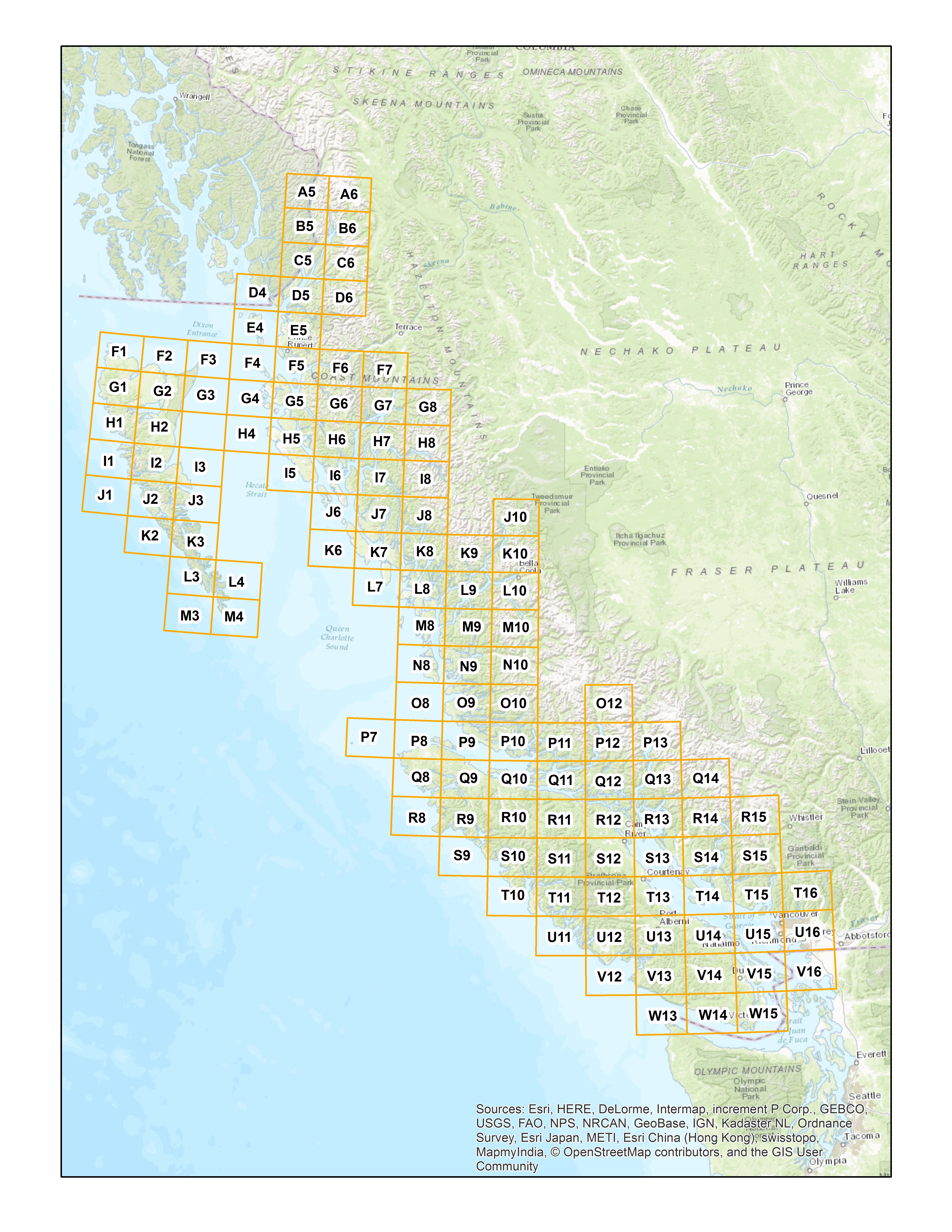
Topographic Maps for Preppers & Homesteaders
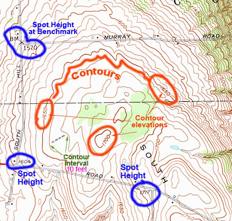
Topographic maps are the foundation of all serious land navigation.
They show:
- Elevation (via contour lines)
- Terrain features (ridges, valleys, saddles)
- Natural barriers and movement corridors
Why they matter
- Identify defensible terrain
- Plan hidden travel routes
- Avoid bottlenecks and ambush points
- Locate water (valleys = drainage)
Prepper advantage
Anyone can follow a road.
Few can navigate terrain.
This is your off-road survival map.
Road & Route Maps for Preppers & Homesteaders
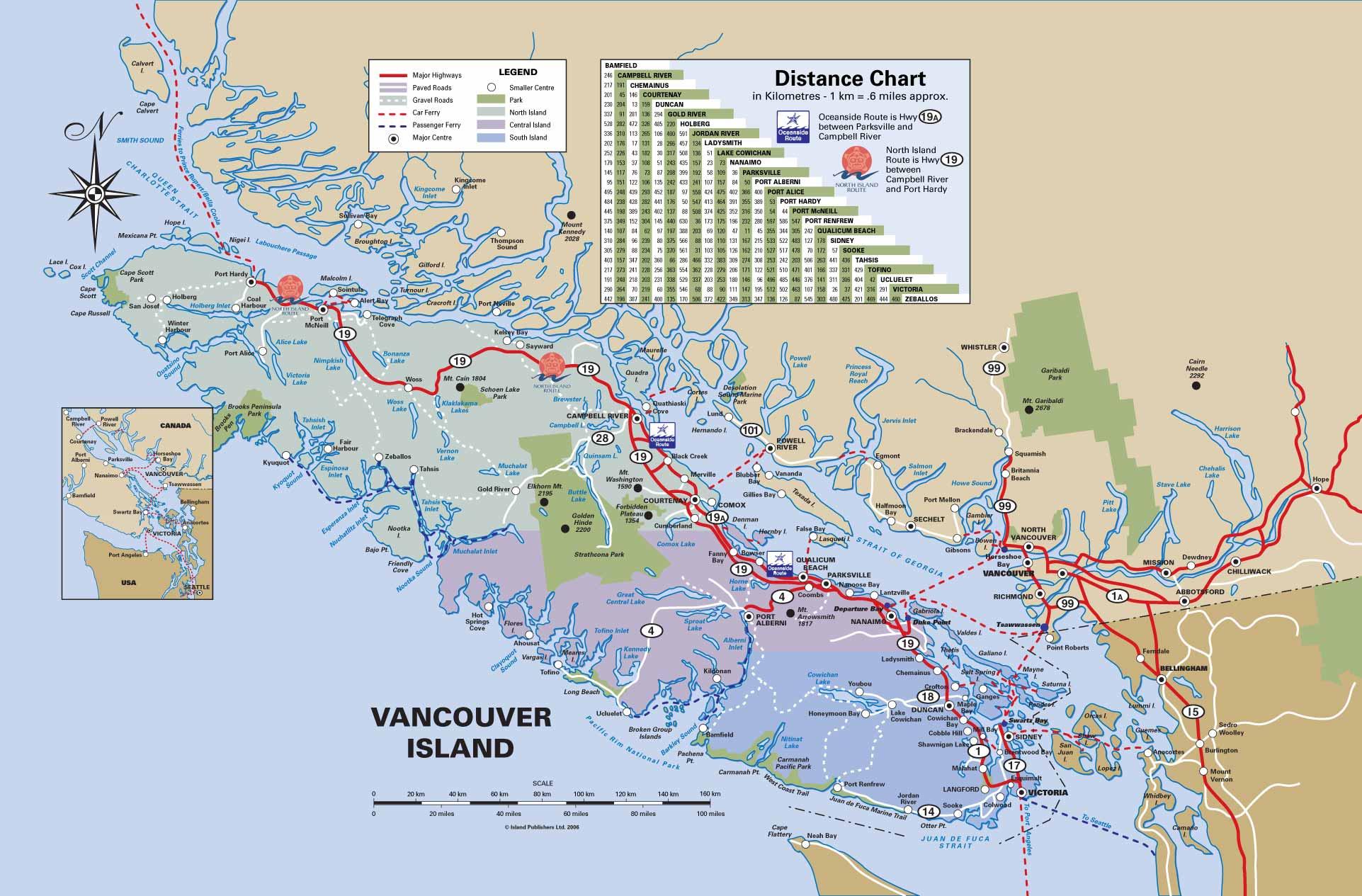
These maps show how people move—and where they’ll get stuck.
Why they matter
- Identify primary vs secondary routes
- Plan evacuation (bug-out) paths
- Find lesser-known backroads
Prepper advantage
- Avoid chokepoints
- Bypass cities
- Build layered escape routes
Roads are fast—but predictable. Use wisely.
Local & County Maps for Preppers & Homesteaders

These maps give hyper-local awareness.
Why they matter
- Identify small access roads
- Understand local layout and jurisdiction
- Know your immediate environment in detail
Prepper advantage
- Better local decision-making
- Faster navigation under stress
- Stronger community planning
This is your home turf map.
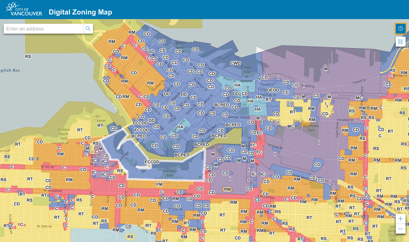
Land Ownership & Parcel Maps
These maps show who owns what.
Why they matter
- Avoid trespassing conflicts
- Identify unused or abandoned land
- Understand land access rights
Prepper advantage
- Plan legal and stealth movement
- Identify potential retreat areas
- Understand resource control
Ownership = control.
Watershed & Water Maps

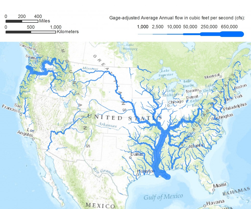
Water is survival.
Why they matter
- Locate rivers, streams, and springs
- Understand water flow direction
- Identify reliable long-term sources
Prepper advantage
- Secure drinking water
- Plan camp locations
- Predict contamination spread
Water maps = life maps.
Floodplain & Flood Risk Maps
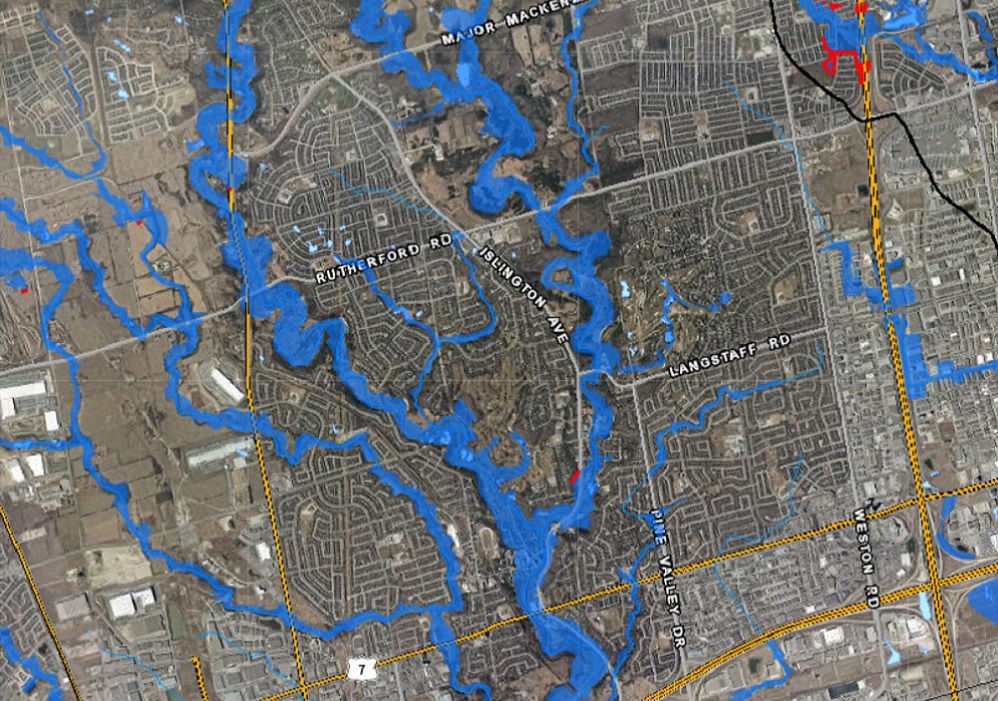
These maps show where NOT to be.
Why they matter
- Identify flood-prone zones
- Avoid dangerous settlement areas
- Plan safe retreat locations
Prepper advantage
- Prevent catastrophic mistakes
- Protect supplies and shelter
Many “perfect” locations fail because of flooding.
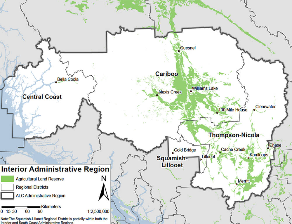
Soil & Agricultural Maps

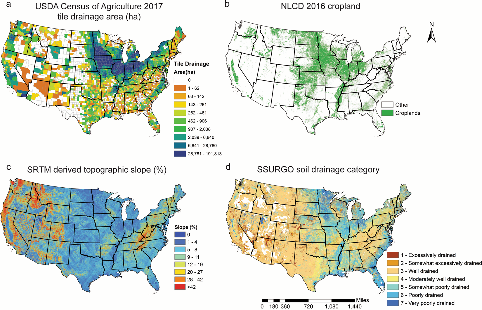
These maps determine whether you can grow food or not.
Why they matter
- Identify fertile land
- Understand drainage and composition
- Plan long-term food production
Prepper advantage
- Choose viable homestead locations
- Maximize yields
- Avoid wasted effort
Soil determines survival sustainability.
Foraging & Wild Food Maps

These maps show what nature provides for free.
Why they matter
- Locate edible plants and fungi
- Identify seasonal resources
Prepper advantage
- Supplement food stores
- Reduce dependency on supply chains
Knowledge here multiplies calories without effort.
Wildfire Risk Maps


Fire can erase everything.
Why they matter
- Identify high-risk areas
- Plan evacuation routes
Prepper advantage
- Avoid building in danger zones
- Plan seasonal strategies
Fire risk = long-term viability risk.
Seismic & Geological Hazard Maps
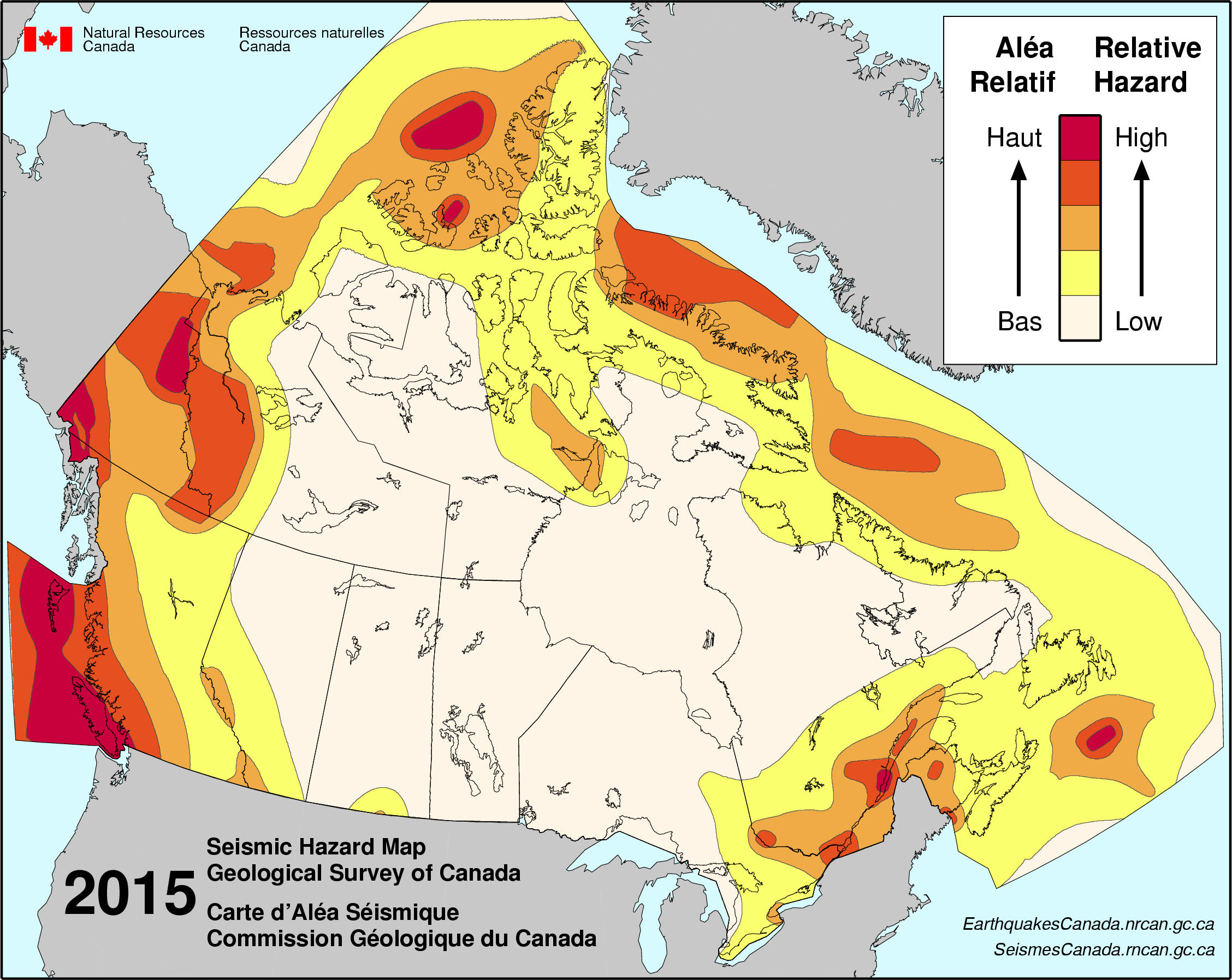
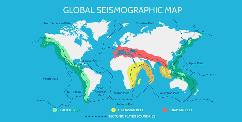
These maps show invisible threats.
Why they matter
- Identify earthquake zones
- Understand landslide risk
Prepper advantage
- Choose safer locations
- Harden infrastructure
The ground itself can fail.
Climate & Weather Pattern Maps


Why they matter
- Understand seasons and extremes
- Plan food, shelter, and clothing
Prepper advantage
- Predict long-term conditions
- Optimize survival strategy
Climate defines your operating environment.
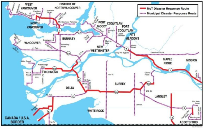
Infrastructure & Critical Systems Maps

These maps show the system behind society.
Why they matter
- Identify vulnerabilities
- Understand dependencies
Prepper advantage
- Predict outages
- Avoid high-risk areas
Infrastructure = fragility map.
Population Density Maps

These maps show where people are.
Why they matter
- Identify high-risk areas during crises
Prepper advantage
- Avoid chaos zones
- Find low-pressure regions
People = pressure.
Best Places to Survive Off the Land Maps
These combine:
- water
- soil
- climate
- terrain
Why they matter
- Identify long-term survival zones
Prepper advantage
- Build sustainable plans
This is where everything comes together.
Best Bug-Out Location Maps
These focus on:
- accessibility
- concealment
- defensibility
Why they matter
- Pre-plan evacuation destinations
A plan without a destination is not a plan.
General Prepper Maps (Layered Decision Maps)
These are combined overlays of multiple map types.
Why they matter
- Turn data into decisions
This is where preppers become strategists.
Historical Maps & Abandoned Infrastructure
These reveal:
- old roads
- forgotten routes
- abandoned structures
Prepper advantage
- Hidden movement options
- overlooked resources
The past leaves behind advantages.
Personal, Hand-Drawn & Community Maps
Your own maps are often the most valuable.
Why they matter
- Capture real-world observations
No digital system beats firsthand knowledge.
Offline Mapping Systems & Redundancy
Digital maps fail.
Why they matter
- Ensure access without power/internet
Prepper strategy
- paper maps
- offline apps
- backups
Redundancy = reliability.
Building Your Own Prepper Atlas
This is the end goal.
Combine:
- all map types
- local knowledge
- layered planning
What you create
A personal survival intelligence system
Not just maps—decision dominance.
Final Thought
Most people carry a map.
Preppers build map systems.
If you master these 20 categories, you will:
- move smarter
- choose better locations
- avoid hidden risks
- and operate with real-world awareness