
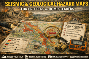
Understanding ground failure, not just earthquakes — and why the land itself can become a threat
When people think about earthquakes, they picture shaking buildings and falling objects. What most people don’t understand is that the shaking is often not the most dangerous part.
The real damage — and long-term disruption — usually comes from geological failure:
- ground liquefaction
- landslides
- fault rupture
- subsidence
- rockfall
- infrastructure collapse tied to unstable ground
Seismic and geological hazard maps exist to show where the ground itself becomes unreliable. For preppers and homesteaders, these maps are not about predicting earthquakes. They are about choosing land, routes, and plans that don’t quietly fail when the earth moves.
You don’t need to live on a major fault line to be affected. Many of the worst outcomes occur far from epicenters, in places where geology amplifies damage.
What seismic & geological hazard maps actually show
These maps typically include:
- known fault lines (active and inactive)
- earthquake shaking intensity zones
- liquefaction susceptibility
- landslide and slope-failure risk
- subsidence-prone areas
- unstable soils and bedrock types
Some maps focus on probability, others on impact severity, and the best ones combine both with terrain and soil data.
In practical terms, these maps answer questions like:
- Where will shaking be amplified?
- Where will the ground behave like liquid?
- Which slopes are likely to fail?
- Which areas repeatedly suffer infrastructure damage?
- Where does rebuilding fail again and again?
Preparedness starts with understanding how the ground behaves under stress.
Why seismic & geological maps matter for preparedness
1) Shaking damage is often secondary to ground failure
Buildings don’t usually fail just because of shaking — they fail because:
- foundations shift
- soils lose strength
- slopes collapse
- buried infrastructure breaks
Liquefaction zones, for example, can turn solid-looking ground into something resembling quicksand for seconds or minutes. Roads buckle. Pipelines rupture. Buildings tilt or sink.
Seismic maps make these invisible risks visible.
2) Geological damage lasts far longer than shaking
An earthquake may last seconds. Geological damage can last months or years:
- landslides block roads indefinitely
- subsidence permanently changes drainage
- broken water lines contaminate supply
- access routes remain unsafe
Preparedness planning that focuses only on the event — not the aftermath — is incomplete.
3) Emergency response is limited by geology
After major seismic events:
- roads may be impassable
- bridges may be unsafe
- response resources are overwhelmed
Geological hazard maps help you identify areas that will be:
- deprioritized
- difficult to access
- isolated longer
Preparedness means planning for delayed help, not assuming rapid recovery.
Why seismic & geological maps are critical for homesteaders
Homesteaders often choose land for beauty, privacy, or affordability — all of which can correlate with geological risk.
These maps help homesteaders:
- avoid building on unstable slopes
- identify liquefaction-prone soils
- plan safer building placement
- design drainage to reduce slope failure
- understand long-term land movement
Many homesteads that “mysteriously” crack, shift, or flood are simply responding to geological realities that were never checked.
Liquefaction: the hazard most people ignore
Liquefaction occurs when:
- loose, water-saturated soils
- lose strength during shaking
- temporarily behave like a liquid
Liquefaction-prone areas are often:
- river valleys
- coastal plains
- reclaimed land
- floodplains with sandy soils
Maps that show liquefaction susceptibility are among the most valuable — and least consulted — tools for land selection.
A beautiful, flat property near water can be one of the worst places to build in a seismic event.
Landslides and slope failure: slow disasters with fast triggers
Landslides don’t require massive earthquakes. They are often triggered by:
- moderate shaking
- heavy rainfall
- soil saturation
- wildfire burn scars
Geological maps reveal:
- historic slide areas
- unstable slopes
- soil types prone to movement
These risks compound with flood and wildfire hazards — which is why map layering matters.
Real-world prepper use cases for seismic & geological maps
Evaluating “safe” regions realistically
Some areas are marketed as low-risk simply because earthquakes are rare. Geological maps often reveal:
- high landslide risk
- subsidence problems
- unstable fill
- weak soils
Preparedness requires looking beyond seismic headlines.
Planning water, fuel, and access redundancy
Geological failure often breaks:
- water mains
- fuel pipelines
- sewer lines
Maps help you identify where these systems are most vulnerable — and where backups are essential.
Choosing bug-out and fallback locations wisely
A fallback location that:
- sits on unstable slopes
- depends on one bridge
- lies in liquefaction-prone soils
…may be worse than staying put.
Your bug-out maps gain credibility when geological hazards are factored in.
Where to find seismic & geological hazard maps (real sources)
United States
- USGS Earthquake Hazards Program — seismic hazard, faults, shaking maps.
https://earthquake.usgs.gov/ - USGS Landslide Hazards Program — landslide susceptibility and risk.
https://www.usgs.gov/programs/landslide-hazards
Canada
- Natural Resources Canada – Earthquakes Canada
Seismic hazard and fault information.
https://earthquakescanada.nrcan.gc.ca/ - Provincial geological surveys (often provide detailed landslide and soil instability mapping).
(Tip: local geological surveys are often more actionable than national overviews.)
Offline strategy for seismic & geological maps
What to keep offline
- seismic hazard map for your region
- liquefaction susceptibility zones
- landslide risk maps
- notes on unstable slopes and soils
What to annotate
- buildings and routes to avoid
- alternate access routes
- water and utility vulnerability
Geology changes slowly — but your exposure increases when development and climate pressures grow.
Practice drills that build geological awareness
Drill A: “Ground truth”
Compare geological maps with visible signs:
- cracked pavement
- tilted trees
- slumping slopes
- recurring road repairs
These often align perfectly.
Drill B: “Aftershock thinking”
Ask:
- What happens if this slope moves after initial shaking?
- Which routes become unsafe?
Drill C: “Layered risk”
Overlay seismic maps with flood, wildfire, and soil maps to identify compounding hazards.
Common mistakes with seismic & geological maps
- Mistake: focusing only on fault lines
Fix: most damage comes from soil behavior, not fault rupture. - Mistake: assuming distance equals safety
Fix: geology amplifies effects far from epicenters. - Mistake: ignoring secondary hazards
Fix: landslides and liquefaction cause long-term disruption. - Mistake: assuming insurance equals resilience
Fix: insurance doesn’t restore access or utilities.
How seismic & geological maps connect to your Prepper Map Packs
Your curated maps for:
- best places to live
- bug-out locations
- survive-off-the-land regions
…are strengthened by geological reality.
Seismic and geological maps act as a reality filter, helping users avoid locations that fail structurally under stress — even if they look ideal on the surface.
This fits cleanly into the series narrative:
“Preparedness isn’t about eliminating risk — it’s about choosing land that fails slowly, predictably, and recoverably.”