
Why people — not disasters — often determine how bad things get
Earthquakes shake. Floods rise. Fires burn.
But in most real-world disruptions, human pressure is what turns problems into crises.
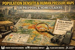
Population density and human pressure maps exist to show where people concentrate, how they move, and where stress accumulates first. For preppers and homesteaders, these maps are not about fear of crowds — they are about predictability.
People behave in patterns. When systems strain, those patterns tighten. Density maps make those patterns visible before roads clog, stores empty, and tempers flare.
What population density & human pressure maps actually show
These maps typically display:
- population per square mile/kilometer
- urban vs suburban vs rural gradients
- commuter corridors
- growth and decline trends
- daytime vs nighttime population shifts
- sometimes demographic pressure indicators
Some maps focus on static density, others on movement and flow. Both matter.
In preparedness terms, these maps answer questions like:
- Where will demand spike first?
- Which areas empty — and which fill up — under stress?
- Where does competition for resources become intense?
- How far does urban pressure extend into rural areas?
Understanding this helps you avoid being surprised by human behavior.
Why population density maps matter for preparedness
1) Scarcity becomes visible before it becomes violent
In disruptions, scarcity appears first in dense areas:
- grocery shelves empty faster
- fuel lines form earlier
- medical services overload
- emergency response slows
Population maps show where demand outpaces capacity earliest.
Preparedness improves when you plan around these zones instead of through them.
2) People move — and they move predictably
When stress increases, people tend to:
- move toward familiarity (home, family)
- follow major corridors
- leave dense cores for perceived safety
Population pressure maps combined with road maps help identify:
- likely evacuation flows
- rural areas that will see sudden influx
- towns that become bottlenecks
Many rural communities are unprepared for sudden population spikes.
3) Density amplifies every other hazard
High-density areas experience:
- faster grid failures
- more severe supply shortages
- delayed emergency response
- increased conflict potential
Population maps help explain why the same event produces radically different outcomes in different places.
Why human pressure maps matter for homesteaders
Homesteaders often assume rural equals insulated. That’s only true if:
- access is limited
- resources scale locally
- population pressure remains low
Human pressure maps help homesteaders:
- understand urban spillover
- anticipate increased traffic or trespass
- plan security and access realistically
- evaluate long-term livability
Many rural areas near cities function as pressure valves — quiet until suddenly overwhelmed.
Daytime vs nighttime population: the hidden layer
Some areas look lightly populated — until you consider:
- commuters
- seasonal workers
- tourism
- recreation areas
Daytime population maps reveal:
- business districts that empty at night
- resort areas that flood seasonally
- rural corridors with heavy transient use
Preparedness plans that ignore this layer often fail during holidays, weekends, or evacuation events.
Growth trends matter more than raw numbers
Population density is not static. Trend maps reveal:
- fast-growing exurban zones
- declining rural areas
- shifting commuter belts
For preparedness, growth trends indicate:
- where infrastructure will be strained
- where competition for land and water will increase
- where services may lag behind population
A low-density area today may not stay that way.
Real-world prepper use cases for population maps
Choosing lower-pressure places to live
Your “best places to live” and general prepper maps become more grounded when population pressure is included:
- moderate density
- slow growth
- local resource capacity
Preparedness favors places that don’t spike under stress.
Evaluating bug-out realism
Bugging out toward population flows often increases risk.
Population maps help determine:
- which directions people will flee
- which rural areas will be overwhelmed
- where resources will be stripped quickly
Sometimes the safest choice is not moving at all.
Planning supply timing
Knowing where pressure builds first helps you:
- stock early
- avoid peak demand
- choose quieter procurement routes
Prepared people don’t compete with crowds.
Where to find population density & pressure maps (real sources)
United States
- U.S. Census Bureau – Population & Density Maps
https://www.census.gov/geographies/mapping-files/time-series/geo.html - Census TIGERweb (interactive boundary and density context).
https://tigerweb.geo.census.gov/tigerweb/
Canada
- Statistics Canada – Population & Census Geography
https://www12.statcan.gc.ca/census-recensement/2021/geo/sip-pis/index-eng.cfm
(Tip: combining census data with road maps reveals movement pressure far better than density alone.)
Offline strategy for population awareness
What to keep offline
- population density map for your region
- maps showing nearby urban centers
- commuter corridor overlays
What to annotate
- towns that swell seasonally
- choke points near dense areas
- locations where demand spikes early
Population pressure changes — revisit after census updates.
Practice drills that build human-pressure awareness
Drill A: “Follow the flow”
Pick a nearby city and trace the most likely outward movement routes under stress.
Drill B: “Pressure ring”
Draw rings at 25, 50, and 100 miles from a metro area. Note where population pressure drops sharply — and where it doesn’t.
Drill C: “Quiet times”
Observe where people don’t go during normal times. Those patterns matter during disruptions.
Common mistakes with population maps
- Mistake: assuming rural equals empty
Fix: check commuter and seasonal pressure. - Mistake: focusing only on city centers
Fix: pressure spreads outward fast. - Mistake: ignoring growth trends
Fix: today’s quiet area may not stay quiet. - Mistake: underestimating human behavior
Fix: people follow habits, not logic.
How population maps connect to your Prepper Map Packs
Population density and pressure maps act as a reality check for:
- bug-out locations
- survive-off-the-land regions
- best places to live
They explain why some otherwise ideal locations become untenable under stress — not because of geography, but because of people.
This fits perfectly into the series narrative:
“Preparedness isn’t just about surviving hazards — it’s about avoiding human bottlenecks.”