
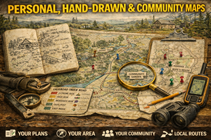
18. Personal, Hand-Drawn & Community Maps
Why the most valuable maps are often the ones that don’t exist yet
Some of the most useful maps for preparedness will never come from a government agency, a satellite, or a website. They live in people’s heads, notebooks, and shared experiences.
Personal, hand-drawn, and community maps capture local knowledge — the kind of information that doesn’t show up on official layers but determines how things actually work on the ground.
For preppers and homesteaders, these maps turn awareness into advantage and community into resilience.
What personal & community maps actually are
These maps are informal by design. They often include:
- footpaths and informal trails
- seasonal water sources
- locally known hazards
- quiet access points
- neighbor skills and resources
- unwritten boundaries and norms
They don’t need to be precise to be powerful. Their value comes from context, not perfection.
In practical terms, they answer questions like:
- Which road floods first?
- Which trail stays passable after storms?
- Where does snow drift deepest?
- Who has a generator?
- Who has tools, skills, or space?
No official map will ever answer those questions for you.
Why personal maps matter for preparedness
1) Official maps lag reality
Government and commercial maps are:
- slow to update
- generalized
- optimized for normal conditions
Local knowledge updates daily.
Personal maps capture:
- new obstructions
- recent construction
- informal routes
- changing conditions
Preparedness improves when your information moves faster than institutions.
2) Small details decide outcomes
In emergencies, success often hinges on:
- one dry route
- one working well
- one open gate
- one neighbor who knows how to fix something
Personal maps highlight decisive details that don’t justify inclusion on official layers but matter when options narrow.
3) Memory fails under stress — maps don’t
Stress degrades recall. Hand-drawn maps act as:
- cognitive anchors
- decision aids
- shared reference points
Even rough sketches reduce hesitation and mistakes.
Prepared people don’t rely on memory alone.
Community maps: resilience multiplied
Community maps pool individual knowledge into something stronger.
They may include:
- shared water access points
- mutual aid locations
- storage areas
- medical skill availability
- communication plans
These maps don’t need to be public. In fact, discretion often increases their value.
Preparedness shifts from individual survival to collective stability when community mapping exists.
Why these maps matter for homesteaders
Homesteaders often develop deep, practical knowledge over time:
- microclimates on their land
- soil differences by field
- wind patterns
- seasonal access changes
Capturing this knowledge in map form:
- preserves it across generations
- supports decision-making
- helps newcomers integrate
- reduces repeated mistakes
A homestead map becomes a living document, not a static drawing.
Types of personal & community maps worth creating
Access & movement maps
- footpaths
- informal roads
- seasonal routes
- gate and fence logic
These matter more than official roads during disruptions.
Resource maps
- wells and springs
- edible plant zones
- firewood areas
- tool caches
Ethics and legality matter — these maps should reflect responsible use.
Risk & hazard maps
- flood-prone areas
- wildfire exposure zones
- unstable slopes
- known problem spots
Local hazard awareness often surpasses official modeling.
Skill & support maps
- who knows first aid
- who has mechanical skills
- who owns equipment
- who has space or shelter
These maps turn communities into networks, not collections of individuals.
How to create useful hand-drawn maps (without overthinking it)
Start simple
Use:
- pencil and paper
- notebooks
- printed base maps
Accuracy improves over time. Start with what you know.
Use symbols and notes
Create a legend:
- arrows for movement
- dots for resources
- shading for risk
Consistency matters more than artistry.
Update regularly
Conditions change. Make updating:
- seasonal
- event-driven
- collaborative
Maps should evolve as reality does.
Offline importance: when these maps matter most
Personal and community maps shine when:
- power is out
- networks are down
- devices fail
- stress is high
They:
- work without batteries
- can be shared instantly
- don’t require permissions
- preserve autonomy
Preparedness is stronger when it doesn’t depend on technology.
Practice drills for personal & community mapping
Drill A: “Draw it from memory”
Sketch your area from memory. Then compare it to reality. Gaps reveal blind spots.
Drill B: “Walk and mark”
Take a walk with a notebook. Mark:
- obstacles
- access points
- resource locations
Drill C: “Swap maps”
Have two people map the same area separately. Compare notes. Differences matter.
Common mistakes
- Mistake: waiting for perfection
Fix: usefulness beats accuracy early. - Mistake: oversharing sensitive info
Fix: trust and discretion matter. - Mistake: letting maps go stale
Fix: schedule updates. - Mistake: assuming everyone knows what you know
Fix: write it down.
How this fits your Prepper Map ecosystem
Personal and community maps are the final layer that turns your platform’s curated data into lived reality.
They:
- personalize regional maps
- ground abstract data
- build trust and cooperation
They align directly with your mission:
“Preparedness works best when people share knowledge, not just information.”