
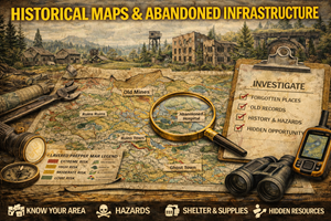
17. Historical Maps & Abandoned Infrastructure
Why the past quietly shapes today’s access, routes, and hidden advantages
Most people treat maps as snapshots of the present. Prepared people learn to read time into their maps.
Historical maps and abandoned infrastructure maps reveal what used to exist — and what still quietly influences movement, access, and survivability today. Old roads don’t vanish. Rail grades don’t disappear. Former towns leave behind clearings, wells, bridges, and rights-of-way that still shape the land long after they fall off modern maps.
For preppers and homesteaders, these maps are not nostalgia. They are strategic context.
What historical maps & abandoned infrastructure actually show
These maps often reveal:
- former roads and wagon routes
- abandoned rail lines and rail grades
- historic river crossings and ferries
- ghost towns and former settlements
- old mines, mills, and industrial sites
- historic land use patterns
Even when infrastructure is gone, the corridors remain. Terrain remembers human use.
In practical terms, these maps answer:
- Why is this ridge clear of trees?
- Why does this “trail” feel engineered?
- Why does water pool here unnaturally?
- Why does this road suddenly straighten?
The past explains the present.
Why historical maps matter for preparedness
1) Old routes often become modern fallback routes
Abandoned roads and rail beds:
- follow stable grades
- avoid steep terrain
- cross rivers at proven points
They were engineered for movement before modern machinery and fuel.
In disruptions, these routes:
- avoid modern choke points
- bypass towns
- remain passable on foot or bike
Prepared people know where they are — even if they’re not obvious.
2) Rights-of-way often persist long after use ends
Many historic corridors remain:
- legally protected
- publicly accessible
- informally maintained
Modern maps may omit them, but historical maps reveal:
- access corridors others don’t see
- why fences break where they do
- how land was intended to be crossed
Understanding historic access reduces guesswork.
3) Old settlements reveal resource logic
People didn’t settle randomly.
Historic towns often existed because of:
- water access
- fertile soil
- trade routes
- defensible terrain
Even if a town failed economically, the geographic logic often remains valid.
Preparedness improves when you understand why people lived somewhere before modern systems.
Abandoned infrastructure: asset and risk
Roads & rail beds
- Provide low-energy travel
- Offer predictable grades
- Often skirt flood zones
But may also:
- conceal washouts
- cross unstable bridges
- collect runoff
Maps help evaluate both sides.
Old industrial sites
Mills, mines, and factories often sit near:
- water sources
- transport corridors
They may offer:
- structural remnants
- flat ground
- access routes
But they can also carry contamination risk — which is why pairing historical maps with environmental awareness matters.
Why these maps matter for homesteaders
Homesteaders often inherit land shaped by prior use.
Historical maps explain:
- odd property lines
- unexplained clearings
- soil differences
- drainage problems
- lingering access paths
Understanding past land use helps homesteaders:
- avoid rebuilding old mistakes
- repurpose existing features
- locate hidden assets like wells or terraces
A homestead becomes stronger when it works with the land’s history, not against it.
Real-world prepper use cases
Quiet movement routes
Historic routes allow movement:
- without drawing attention
- away from major roads
- along terrain-tested paths
These routes often outperform modern alternatives under stress.
Resource discovery
Old maps reveal:
- former orchards
- abandoned fields
- forgotten water sources
These can supplement modern systems when used ethically and legally.
Explaining anomalies
Historical context often explains:
- unusual erosion
- strange vegetation patterns
- recurring maintenance issues
Preparedness improves when surprises stop being mysterious.
Where to find historical maps & infrastructure data
United States
- USGS Historical Topographic Map Collection (HTMC)
https://www.usgs.gov/programs/national-geospatial-program/historical-topographic-maps-preserving-past - Library of Congress – Map Collections
https://www.loc.gov/maps/collections/
Canada
- Library and Archives Canada – Maps & Atlases
https://library-archives.canada.ca/ - Atlas of Canada historical layers
https://atlas.gc.ca/
(Tip: comparing multiple time periods reveals patterns faster than studying one map.)
Offline strategy for historical maps
What to keep printed
- historic maps of your region
- overlays comparing old vs new routes
- notes on former access points
What to annotate
- still-passable corridors
- collapsed crossings
- areas reclaimed by nature
Historical knowledge compounds over time.
Practice drills
Drill A: “Then vs now”
Overlay an old map on a modern one and identify:
- routes that vanished
- structures that remain
- access points still usable
Drill B: “Why here?”
Pick an abandoned site and ask:
- Why did people choose this spot?
- What still works?
- What failed — and why?
Drill C: “Hidden paths”
Walk one old route and note:
- grade consistency
- drainage behavior
- vegetation differences
Common mistakes
- Mistake: romanticizing the past
Fix: history informs, it doesn’t replace modern analysis. - Mistake: ignoring contamination risk
Fix: old sites need cautious evaluation. - Mistake: assuming abandonment means useless
Fix: infrastructure often outlives its purpose.
How this fits your Prepper Map ecosystem
Historical maps add depth to:
- bug-out planning
- local access maps
- survivability analysis
They reveal options invisible on modern layers alone.
This reinforces a core principle:
“Preparedness is not just about seeing what is — it’s about remembering what was.”