
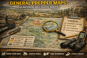
16. General Prepper Maps (Layered Decision Maps)
Turning information into decisions — and decisions into calm action
By this point in the series, one thing should be clear: no single map tells the whole story.
Topographic maps show terrain.
Road maps show movement.
Flood maps show water risk.
Wildfire maps show burn behavior.
Population maps show human pressure.
General Prepper Maps exist to layer all of these realities together into one usable framework — not to overwhelm, but to simplify decision-making when time, information, and emotions are limited.
These are the maps that turn knowledge into judgment.
What General Prepper Maps actually are
General Prepper Maps are composite decision maps. They do not replace specialized maps — they organize them.
They typically integrate:
- terrain (topography)
- water systems and watersheds
- soil and food potential
- climate and seasonal stress
- hazard exposure (flood, fire, seismic)
- infrastructure dependence
- population density and pressure
- access and legal boundaries
Instead of answering one narrow question, they answer:
- Is this place viable?
- What fails first here?
- What options remain when conditions change?
They are about situational clarity, not detail overload.
Why layered maps matter more than any single map
1) Real crises don’t happen in isolation
In the real world:
- floods follow wildfires
- power failures disrupt water
- population movement overwhelms roads
- heat waves stress the grid
Single-layer thinking leads to blind spots. Layered maps reveal compound risk — where multiple stressors intersect.
Preparedness improves when you avoid places that fail in more than one way.
2) Good decisions require trade-offs, not perfection
There is no zero-risk location. Layered maps help you:
- identify acceptable risks
- avoid stacked risks
- choose places that fail slowly
- understand what you’re trading for what
Preparedness isn’t about finding the best place — it’s about choosing the least bad option under real conditions.
3) Layering simplifies decisions under stress
Paradoxically, more information can make decisions easier if it’s organized correctly.
General Prepper Maps allow you to:
- eliminate clearly bad options quickly
- narrow viable zones
- focus on realistic choices
That’s critical when:
- time is short
- information is incomplete
- emotions are high
The core layers every General Prepper Map should include
1) Terrain & access layer
- elevation
- slope
- choke points
- visibility
This determines movement, exposure, and energy cost.
2) Water & food viability layer
- surface and groundwater
- soil productivity
- forage potential
Without this layer, all other planning is theoretical.
3) Hazard exposure layer
- flood zones
- wildfire corridors
- seismic risk
- extreme weather exposure
This layer filters out places that fail catastrophically.
4) Human pressure layer
- population density
- growth trends
- likely movement patterns
This layer explains why some places collapse socially before they fail physically.
5) Infrastructure dependence layer
- power
- water treatment
- fuel access
- medical services
This layer reveals how long modern systems support you — and when they stop.
How to read a layered map (without overthinking it)
A simple approach:
Step 1: Eliminate stacked-risk zones
If an area has:
- flood risk + wildfire risk
- high population pressure + fragile infrastructure
…it’s not a good prepper choice.
Step 2: Identify slow-failure regions
Look for areas where:
- hazards exist but are manageable
- population pressure is moderate
- access is flexible
Slow failure gives you time to adapt.
Step 3: Match regions to your skills and needs
A region that’s perfect for one family may be wrong for another.
General Prepper Maps support personalized preparedness, not one-size-fits-all answers.
Why these maps matter for homesteaders
Homesteaders live inside layered systems every day.
General Prepper Maps help homesteaders:
- choose land that rewards effort
- plan infrastructure independence
- avoid repeating regional mistakes
- understand long-term viability
They also support succession planning — how land will behave decades into the future.
A homestead built without layered awareness often becomes fragile over time.
General Prepper Maps vs. single-purpose maps
| Single-Purpose Maps | General Prepper Maps |
| Answer one question | Answer “Is this viable?” |
| Easy to misinterpret | Designed for synthesis |
| Can mislead alone | Reduce blind spots |
| Reactive | Strategic |
Preparedness shifts from reaction to strategy when maps are layered.
Offline importance: why layered maps must be accessible without tech
Layered decisions often need to be made:
- during outages
- under stress
- without reliable connectivity
Printed General Prepper Maps allow:
- group discussion
- calm evaluation
- shared understanding
- faster consensus
Preparedness planning that depends on dashboards and apps is fragile.
Practice drills for using layered maps
Drill A: “Failure stacking”
Pick a region and list:
- first failure
- second failure
- third failure
Then decide if you still want to be there.
Drill B: “Plan B thinking”
Using the same map, identify:
- where you’d move within the region
- what you’d abandon first
- what you’d protect longest
Drill C: “Skill alignment”
Match your real skills to the region’s demands. Be honest.
Common mistakes with General Prepper Maps
- Mistake: trying to eliminate all risk
Fix: focus on managing risk. - Mistake: ignoring human pressure
Fix: people create the fastest breakdowns. - Mistake: over-optimizing for one scenario
Fix: resilience comes from flexibility. - Mistake: paralysis by analysis
Fix: use maps to narrow options, not endlessly compare.
How General Prepper Maps anchor your entire platform
Your General Prepper Maps are the keystone that ties everything together:
- survive-off-the-land regions
- bug-out locations
- best places to live
- hazard avoidance maps
They turn individual insights into coherent preparedness strategy.
This aligns perfectly with your platform’s philosophy:
“Preparedness isn’t about fear or prediction.
It’s about seeing clearly, choosing wisely, and adapting early.”