
Finding food where it actually grows — and why guessing can be dangerous, unethical, or useless
Foraging is one of the most romanticized — and misunderstood — preparedness skills. Many people assume that if grocery stores fail, they can simply “head into the woods” and gather food. In reality, wild food availability is uneven, seasonal, location-specific, and heavily influenced by soil, water, and human pressure.
Foraging and wild food maps exist to replace fantasy with realism.
For preppers, these maps help identify where wild food is most likely to exist, how reliable it is, and where pressure will destroy it quickly. For homesteaders, they support supplemental food strategies, medicinal harvesting, and long-term land stewardship.
Foraging without map literacy is luck. Foraging with maps is planning.
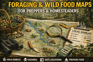
What foraging & wild food maps actually show
Foraging maps don’t usually pinpoint individual plants. Instead, they highlight zones of higher probability, based on:
- ecosystem type
- soil quality and diversity
- moisture availability
- elevation and climate
- historical plant distribution
- human disturbance and access
Good foraging maps are layered. They combine:
- soil maps (what can grow)
- watershed maps (where moisture persists)
- land ownership maps (where access is legal)
- population pressure maps (where overharvesting is likely)
Your site’s foraging maps by state/province do exactly this — they reduce the search space and point people toward realistic regions, not imaginary abundance.
Why foraging maps matter for preparedness
1) Wild food is not evenly distributed
Even within the same forest or region, edible plants cluster in specific conditions:
- certain soil types
- specific moisture zones
- edge habitats
- disturbance corridors (old clearings, burns, floodplains)
Foraging maps help you stop thinking “anywhere” and start thinking “here, not there.”
Preparedness improves when expectations match reality.
2) Pressure destroys forage faster than people expect
During disruptions, many people turn to foraging at the same time. Areas that are:
- close to towns
- easy to access
- visible from roads
…are stripped quickly.
Foraging maps help identify:
- zones likely to be overharvested
- regions with lower human pressure
- areas where sustainable harvest is more realistic
Preparedness means thinking beyond first-day abundance.
3) Foraging without context creates health risks
Many edible plants grow near:
- runoff zones
- roadsides
- industrial sites
- agricultural chemical drift
Foraging maps paired with watershed and land-use data help avoid contamination risks that plant ID apps never warn about.
Why foraging maps matter for homesteaders
For homesteaders, foraging is not about replacement — it’s about supplementation and resilience.
Foraging maps support:
- identifying medicinal plant zones
- supplementing animal feed
- gathering wild greens, berries, and nuts
- maintaining biodiversity
- learning seasonal cycles
They also encourage ethical harvesting practices, which preserve resources long-term.
Homesteads that integrate wild food knowledge tend to be more adaptable and less input-dependent.
The three pillars of realistic foraging
Foraging maps work best when paired with three realities:
1) Seasonality
Wild food availability changes dramatically throughout the year. A map that ignores seasonality creates false confidence.
Good foraging plans always ask:
- What grows here now?
- What grows here later?
- What disappears entirely in drought or cold?
2) Accessibility
A productive zone that:
- requires crossing private land
- lies behind locked access
- depends on seasonal roads
…is not reliable.
Foraging maps must be filtered through land ownership and access maps to remain usable.
3) Regeneration
Wild food is finite. Sustainable foraging requires:
- knowing how fast plants regenerate
- avoiding root destruction
- rotating harvest zones
Maps help spread pressure and protect long-term viability.
Soil, water, and forage: the hidden relationship
Foraging success is strongly correlated with:
- soil diversity (supports more species)
- consistent moisture (supports leafy greens and berries)
- edge environments (forest–meadow, riparian corridors)
Soil and watershed maps explain why certain forage zones exist. Foraging maps show where those conditions overlap at scale.
This is why your foraging maps work best when framed as ecosystem probability maps, not “shopping lists.”
Real-world prepper use cases for foraging maps
Supporting survive-off-the-land strategies
Your “best places to survive off the land” maps become more realistic when paired with forage zones:
- calorie-light but nutrient-dense foods
- medicinal resources
- seasonal supplementation
Foraging rarely provides calories — but it provides micronutrients and resilience.
Reducing reliance on stored food
Stored food is finite. Foraging helps:
- extend supplies
- reduce nutrient deficiencies
- provide variety
- support morale
Maps help prioritize where effort is worth the energy.
Avoiding dangerous assumptions
Foraging maps help prevent:
- relying on invasive or contaminated species
- assuming abundance near population centers
- harvesting in protected or restricted zones
Preparedness favors informed restraint.
Where to find foraging & wild food information (supporting sources)
While foraging maps themselves are often curated (like yours), supporting layers come from authoritative sources:
Ecosystem & vegetation context
- USGS National Map (land cover, hydrography, terrain).
https://www.usgs.gov/tools/download-data-maps-national-map
Canada ecosystem context
- Atlas of Canada / Toporama (vegetation, hydrography, elevation).
https://atlas.gc.ca/toporama/en/index.html
Soil context
- USDA NRCS Web Soil Survey (U.S.).
https://websoilsurvey.nrcs.usda.gov/ - Canadian Soil Information Service (CanSIS).
https://sis.agr.gc.ca/cansis/
(Note: plant ID guides and books are still essential — maps tell you where to look, not what to pick.)
Offline strategy for foraging maps
What to keep offline
- printed foraging zone maps by state/province
- seasonal notes for your region
- soil and water overlays
- land ownership boundaries
What to annotate
- harvest seasons
- access points
- regeneration notes
- “avoid” zones (contamination, overuse)
Foraging knowledge compounds — write it down.
Practice drills that build foraging intelligence
Drill A: “Zone walk”
Visit one mapped forage zone and observe:
- plant diversity
- moisture conditions
- signs of human pressure
Don’t harvest — just learn.
Drill B: “Season shift”
Revisit the same zone in a different season. Note what changes and what disappears.
Drill C: “Pressure test”
Identify which zones near you would be stripped first during a disruption. Plan alternates farther out.
Common mistakes with foraging maps
- Mistake: assuming maps guarantee food
Fix: maps show probability, not inventory. - Mistake: overharvesting one zone
Fix: rotate harvest areas. - Mistake: ignoring legality
Fix: always pair with land ownership maps. - Mistake: relying on foraging for calories
Fix: treat forage as supplementation, not replacement.
How foraging maps connect to your Prepper Map Packs
Your curated Best Places to Forage (by State/Province) maps give users a realistic starting point — far better than random exploration or online hearsay.
In the series, the message is clear:
“Foraging works when it’s mapped, seasonal, ethical, and combined with soil, water, and access awareness.”
This reinforces your platform’s emphasis on quiet, responsible preparedness — not survival fantasy.