

Fire Information for Resource Management System (FIRMS) US / Canada
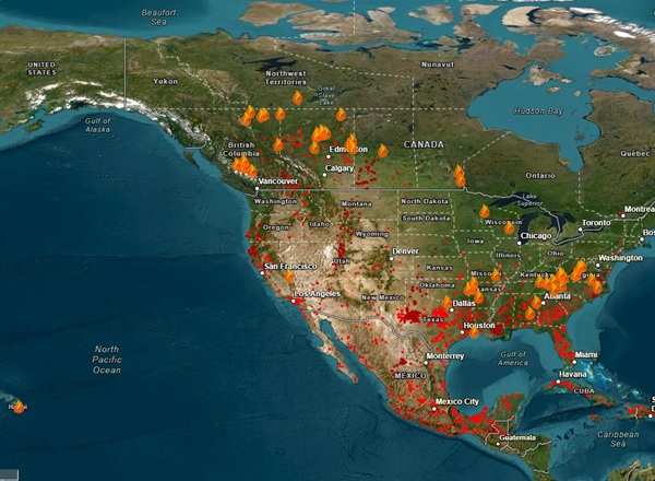
FIRMS US/Canada is a joint effort by NASA and the USDA Forest Service to provide access to low latency satellite imagery and science data products from Earth Observation System (EOS) satellite assets to identify the location, extent and intensity of wildfire activity and its effects.
FIRMS US/Canada tools and applications provide geospatial data, products and services to support strategic fire management needs of US and Canadian agencies and inform the general public.
- Active fire detections, satellite imagery and other relevant data for the US and Canada in an interactive FIRE MAP
- Active fire data in downloadable SHP, KML, TXT formats and Web Map Services
- Satellite imagery accessible from Global Imagery Browse Services (GIBS) and as custom subsets from Worldview Snapshots
- Email/text Fire Alerts for new fire detections within defined areas of interest
- Fire Data Academy features examples of analyzing and visualizing fire data using Google Colaboratory (Colab), Jupyter Notebooks, and Python.
- For Tips, Suggestions and What’s new visit FIRMS Blog
- For Frequently Asked Questions visit FIRMS FAQs
FIRMS US/Canada is enabled by data and applications provided by NASA’s Earth Observing System Data and Information System (EOSDIS), including NASA’s Land, Atmosphere Near real-time Capability for EO (LANCE), as well as data from the direct readout community and technologies facilitated by the NASA Direct Readout Laboratory.