
Seeing the long game — because “normal weather” is no longer a reliable planning assumption
Most people think about weather as something short-term: today’s forecast, this week’s storm, tomorrow’s temperature. Prepared people think differently. They think in patterns, cycles, and trends.
Climate and weather pattern maps exist to answer a deeper question:
What does this place do over time — not just today?
For preppers and homesteaders, these maps are not about climate politics or predictions. They are about risk exposure, resource reliability, and long-term livability. They help you avoid planning your life, food systems, and fallback options around conditions that no longer exist.
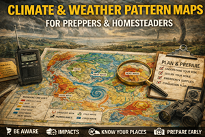
What climate & weather pattern maps actually show
Climate and weather pattern maps typically illustrate:
- long-term temperature averages and extremes
- precipitation patterns (rain vs snow, seasonal timing)
- drought frequency and duration
- storm tracks and intensity trends
- freeze/frost dates and growing seasons
- heat wave and cold snap frequency
Unlike daily forecasts, these maps focus on probability over time. They show what a region tends to experience — and how those tendencies are shifting.
In preparedness terms, they answer questions like:
- Can this place reliably grow food anymore?
- How often does water stress occur?
- Are extreme events becoming more frequent?
- Will infrastructure be stressed regularly?
- Is this trend accelerating or stabilizing?
Why climate & weather maps matter for preparedness
1) Short-term thinking fails in long disruptions
Preparedness planning that relies on “average conditions” often breaks down because averages hide extremes.
Climate maps reveal:
- widening temperature swings
- longer dry periods
- heavier rain events
- compressed growing seasons
These changes stress systems faster than people expect.
Preparedness isn’t about surviving one bad year — it’s about living through several difficult ones in a row.
2) Weather extremes compound other risks
Climate patterns amplify:
- wildfire risk during prolonged drought
- flooding after soil dries and hardens
- grid stress during heat waves or cold snaps
- crop failure when seasons shift unpredictably
Climate maps help you see how multiple hazards stack together — not in isolation.
3) Human systems lag behind climate reality
Infrastructure, zoning, agriculture, and emergency planning are often built around historical norms, not emerging ones.
Climate pattern maps help identify:
- areas where infrastructure is increasingly mismatched
- regions experiencing repeated “once-in-a-generation” events
- places where adaptation is lagging
Preparedness improves when you don’t assume systems will catch up in time.
Why climate maps are essential for homesteaders
Homesteaders are more exposed to climate shifts because they depend on:
- predictable growing seasons
- reliable precipitation
- manageable heat and cold
- stable soils
Climate maps inform:
- crop and livestock selection
- water storage needs
- shelter and building design
- timing of planting and harvest
- long-term land viability
A homestead that thrived 20 years ago may now require entirely different strategies — or may no longer be viable at all.
Growing zones: useful, but incomplete
Many people rely heavily on USDA Plant Hardiness Zones (or Canadian equivalents). These maps are helpful — but limited.
They show:
- average minimum winter temperatures
They do not show:
- summer heat extremes
- drought stress
- rainfall timing
- soil moisture availability
- storm intensity
Preparedness requires going beyond growing zones and understanding the full climate picture.
Precipitation timing matters more than totals
A region receiving the same annual rainfall can behave very differently depending on:
- when rain falls
- how intense storms are
- how fast water runs off
Climate maps help distinguish between:
- slow, soil-recharging rainfall
- intense runoff-driven storms
- snow-based vs rain-based systems
For food production and water security, timing often matters more than volume.
Real-world prepper use cases for climate maps
Choosing resilient places to live
Your site’s “best places to live” and general prepper maps benefit enormously from climate context:
- regions with moderate variability
- areas less prone to repeated extremes
- zones with stable water cycles
Preparedness favors places that fail slowly, not places that swing violently.
Evaluating bug-out realism
A bug-out location that:
- is unreachable during winter storms
- becomes dangerously hot in summer
- relies on snowpack that’s declining
…may not be a reliable fallback.
Climate maps help filter fantasy from practicality.
Planning water and food redundancy
Climate patterns inform:
- how much water storage is enough
- whether rain catchment is reliable
- which crops are resilient vs fragile
- how often backup food systems are needed
This is long-range preparedness, not reaction.
Where to find climate & weather pattern maps (real sources)
United States
- NOAA Climate Data & Maps — temperature, precipitation, drought, extremes.
https://www.climate.gov/maps-data - NOAA National Centers for Environmental Information (NCEI) — historical climate trends.
https://www.ncei.noaa.gov/
Canada
- Environment and Climate Change Canada (ECCC) — climate normals, trends, and projections.
https://climate.weather.gc.ca/ - Canadian Climate Normals — baseline data for planning.
https://climate.weather.gc.ca/climate_normals/
(Tip: regional and local climate summaries are often more useful than global projections.)
Offline strategy for climate awareness
What to keep offline
- climate normal summaries for your region
- seasonal precipitation charts
- heat and cold extreme records
- notes on trend changes over time
What to annotate
- years with crop failure
- repeated drought or flood cycles
- infrastructure stress events
- adaptation measures that worked or failed
Preparedness improves when you track patterns, not just events.
Practice drills that build climate literacy
Drill A: “Ten-year memory”
Review the past 10–20 years of weather extremes in your area. Look for clustering, not averages.
Drill B: “System stress test”
Ask:
- What happens here if summer heat increases by 10%?
- What happens if winter cold snaps last longer?
- What happens if rain arrives later?
Drill C: “Trend vs nostalgia”
Separate how a place used to be from how it behaves now.
Common mistakes with climate maps
- Mistake: assuming averages equal safety
Fix: extremes drive failures. - Mistake: focusing only on temperature
Fix: water and timing matter more. - Mistake: assuming adaptation will be fast
Fix: systems change slowly under stress. - Mistake: planning based on memory
Fix: memory lags reality.
How climate maps connect to your Prepper Map Packs
Climate and weather pattern maps provide the long-range filter for all your curated content:
- best places to live
- bug-out locations
- survive-off-the-land regions
- foraging zones
They explain why certain regions are becoming more fragile — and why others remain comparatively resilient.
This aligns perfectly with your platform’s philosophy:
“Preparedness isn’t fear-based. It’s reality-based.”