
Why most bug-out plans fail — and how realistic location planning actually works
“Bug-out” is one of the most overused and misunderstood terms in preparedness. For many people, it conjures images of dramatic escapes, remote cabins, or disappearing into the wilderness at the first sign of trouble.
In reality, most bug-outs fail not because people lack gear — but because they chose unrealistic locations and misunderstood movement, timing, and human behavior.
Best Bug-Out Locations maps exist to correct that. They are not about fantasy retreats. They are about reachable, survivable, and defensible fallback areas that make sense when systems are stressed, not when conditions are calm.
What a bug-out location really is (and what it is not)
A realistic bug-out location is:
- reachable with limited fuel
- accessible by multiple routes
- outside immediate danger zones
- capable of short- to medium-term living
- low in human pressure at the moment you arrive
A bug-out location is not:
- a long-term off-the-land survival zone
- a place requiring perfect timing
- a spot that assumes empty roads
- a single point with no alternates
Your maps reflect this realism — they prioritize viability under stress, not dream scenarios.
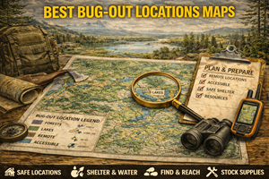
What Best Bug-Out Locations maps actually show
These maps are movement-focused composite maps, typically layering:
- distance and travel time from population centers
- road networks and alternates
- choke points and bottlenecks
- hazard avoidance (flood, fire, seismic)
- population pressure gradients
- terrain accessibility
- infrastructure dependence
Instead of asking “Where is far away?”, they ask:
- Where can I realistically reach?
- Where does pressure drop off fast?
- Where can I pause, reassess, and adapt?
- Where do I still have options?
Bug-out planning is about options, not endpoints.
Why these maps matter for preparedness
1) Distance is less important than reachability
Most failed bug-outs attempt to go too far, too late, using too few routes.
Best bug-out locations:
- are often closer than people expect
- lie just beyond pressure zones
- allow regrouping and decision-making
Your maps emphasize travel logic, not mileage.
2) Human movement determines success
When people move, they:
- follow major roads
- funnel through towns
- stop for fuel and supplies
Bug-out maps that ignore population flow create false safety.
Your maps correctly prioritize:
- locations away from primary corridors
- areas with multiple approach options
- zones that people don’t think to go first
3) Timing matters more than destination
A good bug-out location at the wrong time is worse than staying put.
Your maps support decisions like:
- early, calm movement
- delayed movement after pressure passes
- partial movement to staging areas
Bug-out planning is dynamic, not binary.
Why these maps matter for homesteaders
Even homesteaders may need to bug out:
- wildfire threats
- flooding
- infrastructure collapse
- civil unrest spillover
Best Bug-Out Locations maps help homesteaders:
- identify temporary fallback areas
- avoid driving into pressure
- plan livestock or asset movement
- coordinate with neighbors
Preparedness means planning for movement even if you prefer to stay.
The three layers of a realistic bug-out plan
1) Primary fallback zone
- reachable quickly
- requires minimal planning
- used early if conditions deteriorate
2) Secondary fallback zone
- farther from pressure
- requires more commitment
- used if disruption persists
3) Tertiary options
- opportunistic
- dependent on conditions
- used when plans change
Your maps naturally support this layered thinking.
Common failure points your maps help avoid
Choke points
Bridges, tunnels, mountain passes, and city edges clog fast. Your maps highlight areas beyond these traps.
Fuel dependency
Bug-outs that require refueling en route often fail. Your maps favor locations reachable on a single tank.
Overconcentration
Publicized “safe areas” attract crowds. Your maps avoid obvious convergence zones.
Hazard stacking
Bug-outs into floodplains, fire corridors, or seismic risk zones create secondary crises. Your maps filter these out.
How to use bug-out maps correctly (and calmly)
Step 1: Identify your pressure origin
Where is stress coming from?
- urban unrest
- natural disaster
- infrastructure failure
Step 2: Identify pressure direction
Where will people move away from that stress?
Step 3: Choose zones just beyond the pressure edge
These are often safer than deep rural zones during early phases.
Step 4: Maintain optionality
Never commit to a single destination until conditions demand it.
Your maps guide decision-making, not blind movement.
Offline importance: why bug-out maps must be printed
Bug-outs often occur during:
- power outages
- network congestion
- cell tower failures
Printed maps allow you to:
- adapt routes
- avoid crowds
- make decisions without devices
- communicate plans clearly
A bug-out plan that depends on GPS is fragile.
Practice drills for using bug-out maps
Drill A: “One-tank test”
Can you reach your primary fallback without refueling? If not, adjust.
Drill B: “Route denial”
Assume one major route is blocked. Can you still reach your zone?
Drill C: “Stay vs go”
Use the map to decide at what point staying becomes worse than moving.
Common mistakes people make with bug-out maps
- Mistake: treating them as escape fantasies
Fix: treat them as pressure-management tools. - Mistake: choosing distant destinations
Fix: closer, calmer zones are usually safer. - Mistake: committing too early or too late
Fix: timing beats distance. - Mistake: ignoring human behavior
Fix: people create the most dangerous bottlenecks.
How bug-out maps connect to your Prepper Map Packs
Your Best Bug-Out Locations maps work alongside:
- population pressure maps
- road and route maps
- hazard maps
- infrastructure maps
Together, they create a movement intelligence system — not a panic plan.
This reinforces your platform’s core principle:
“Preparedness isn’t about running away.
It’s about moving only when it improves your position.”